64
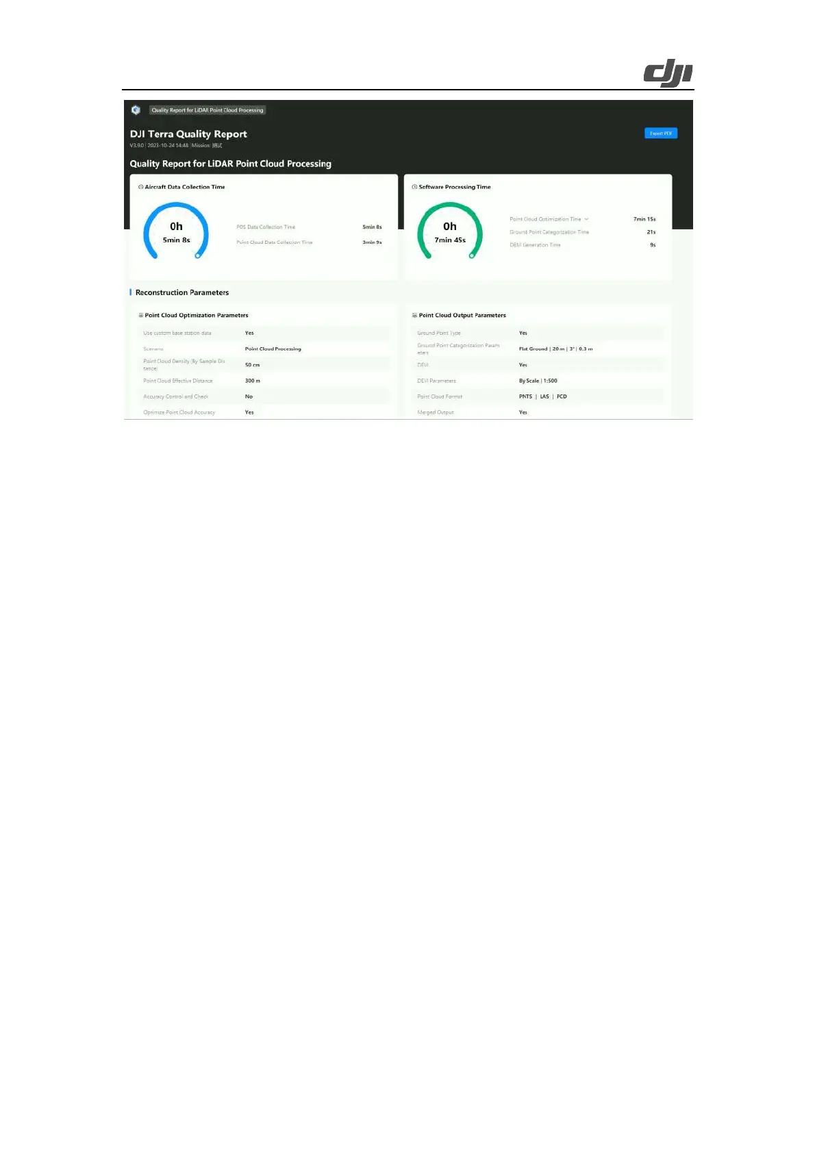
Figure: LiDAR point cloud report
4. Application of Point Cloud Results
Content: List some typical back-end analysis software and common applications, such as
Point Cloud Automata and Lidar360 for terrain extraction, single-tree segmentation, and
tree barrier analysis purposes. For more details about how to use the back-end analysis
software, please contact the corresponding manufacturer to learn more.
The main applications of a LiDAR LAS point cloud include the following.
Surveying and mapping: topographic map surveying and mapping, engineering surveying,
earthwork surveying, river course surveying, emergency surveying and mapping, and others.
Zenmuse L2 features multiple returns and can "penetrate" the edge of vegetation to obtain the
ground point. It can output DEM, contour lines, and other results.
Forestry: single-wood segmentation. Thanks to its multi-return characteristics, Zenmuse L2 can
extract the information of each tree for single-tree segmentation, statistics of the stand origin,
diameter at breast height, average tree height, stand density, stand volume, stand yield rate of wood,
and other forestry survey statistics.
Powerline: tree barrier analysis or provision of a point cloud model for offline refined inspections.
Based on the data contributed by Zenmuse L2 and by using third-party software, you can directly
output a tree barrier analysis report. You can also scan the poles and towers to get their accurate
coordinates and then utilize the Refined inspection module of DJI Terra to perform refined
inspections on power transmission towers.
Others: Zenmuse L2 can also be applied to the emergency field to quickly perform terrain detection,
geological disaster mapping, landslide monitoring, infrastructure digitization, and other actions.
Common point cloud analysis software includes TerraSolid, Point Cloud Automata, LiDAR-DP,
LidarMate, LiDAR360, Point Cloud Magic, and Tovos Powerline.