63
3.2.4.3.2. Display Mode (Coloring)
1. RGB:
Display the result in their true colors.
2. Reflectivity:
Display the result based on the reflectivity received by the radar. The reflectivity is graded on a scale
of 0-255, where 0-150 corresponds to diffuse reflection objects with a reflectivity of 0-100%, and
151-255 corresponds to fully reflective objects. Since the reflected light by the same object may be
received by the LiDAR at different angles, it is possible that the reflectivity values of the same
ground object vary as shown on the reflectivity map. This is a normal phenomenon.
3. Altitude:
Display different colors for different altitudes of the point cloud.
4. Return:
Display different colors for different numbers of returns of the result data.
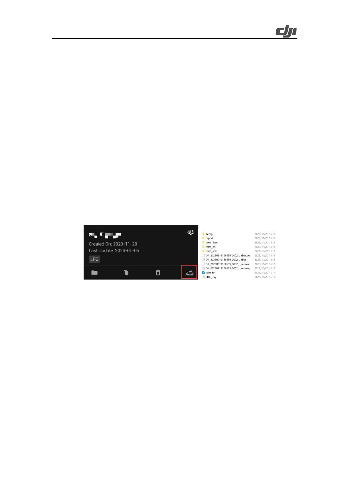
3.2.4.3.3. Result Data Export
In the task bar, click the export icon to export result files. The result files output by DJI Terra include
an LAS point cloud result and an OUT trajectory file.
Figure: Result files output by DJI Terra
3.2.4.3.4. Quality Report
On the reconstruction screen, you can press Ctrl+Alt+F to open the current task folder.
You can vi ew and s a ve t h e r ep ort in HTML f or mat. The report contains relevant information about
the raw data, software parameters, output format, and point cloud processing time. Refer to the
document How to Read a DJI Terra Quality Report on DJI official website for more information.
 Loading...