62
time points during point cloud processing to improve their overall accuracy. For low-overlap power
line scenarios, point cloud accuracy optimization may also cause negative phenomena such as
layering. For this reason, we recommend that you disable this feature.
8. Set Reconstruction Output Format.
3D point clouds of the PNTS (the format used for display in Terra) and the LAS format (the standard
format of airborne radar output) will be output by default. You can also choose to output the point
cloud in a PLY (can be opened in MeshLab), PCD (can be opened in CloudCompare), and S3MB
(can be opened in SuperMap).
9. Click Start Reconstruction.
Click Start Processing to start reconstruction. During processing, you can click Stop to pause the
process and the software will save the current progress. If you resume the progress, the software
will continue data processing from the breakpoint.
10. Start multiple reconstruction tasks.
You can start multiple point cloud processing tasks at the same time. Before the task that is first
started is completed, the other tasks will be pending in the queue. Tasks are processed in the order
they were started and will be started one by one after their previous task is completed.
3.2.4.3. Reconstruction Output
3.2.4.3.1. Browse
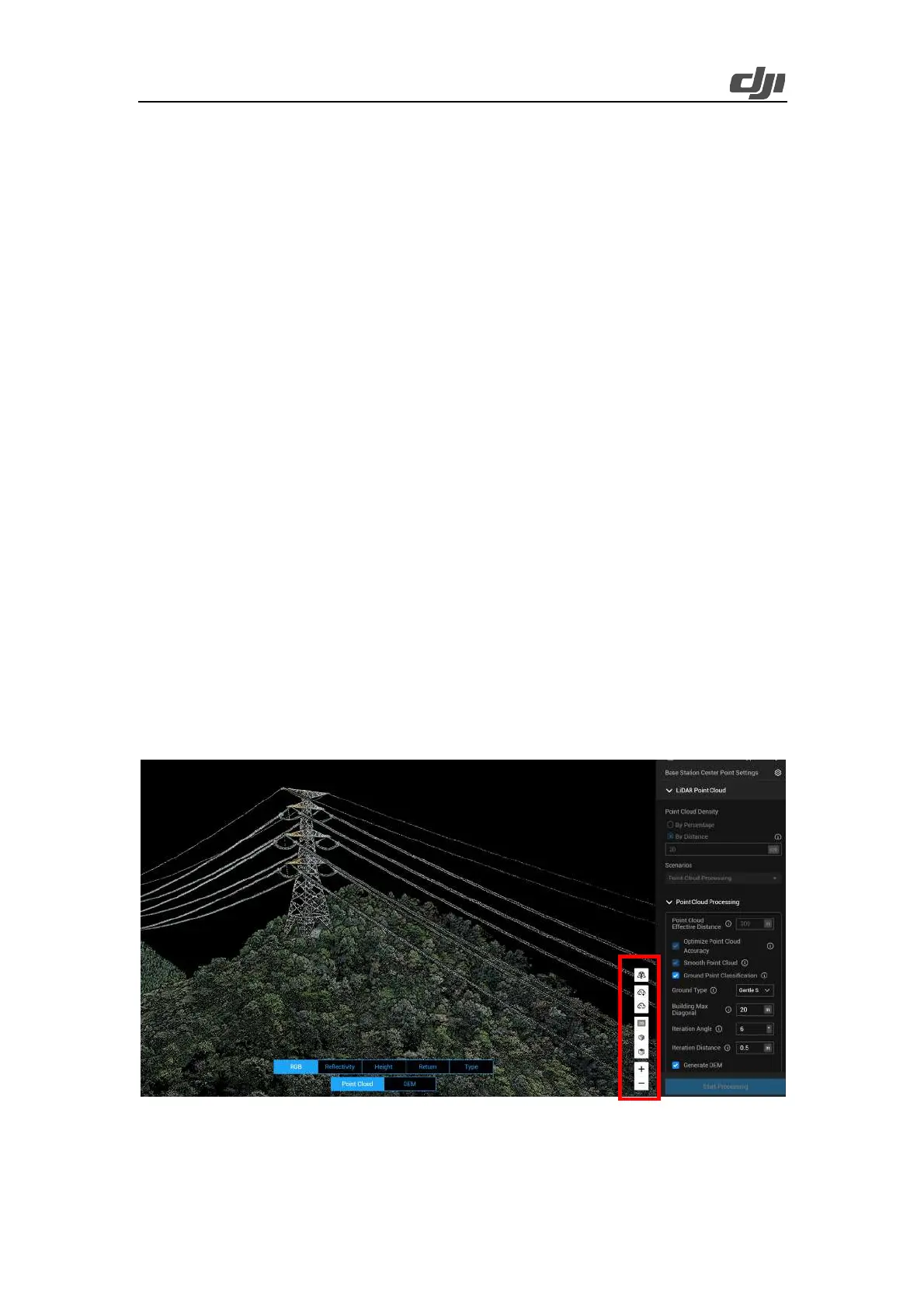
By using the toolbar on the right side of the modeling homepage, you can move, zoom, rotate, or
perform other actions on the result. In the toolbar, you will find the following icons from top to
bottom: automatic rotation, point cloud granularity adjustment, 2D pitch angle, 3D viewing angle,
and model zooming.
Figure: Point cloud model browsing
 Loading...