49
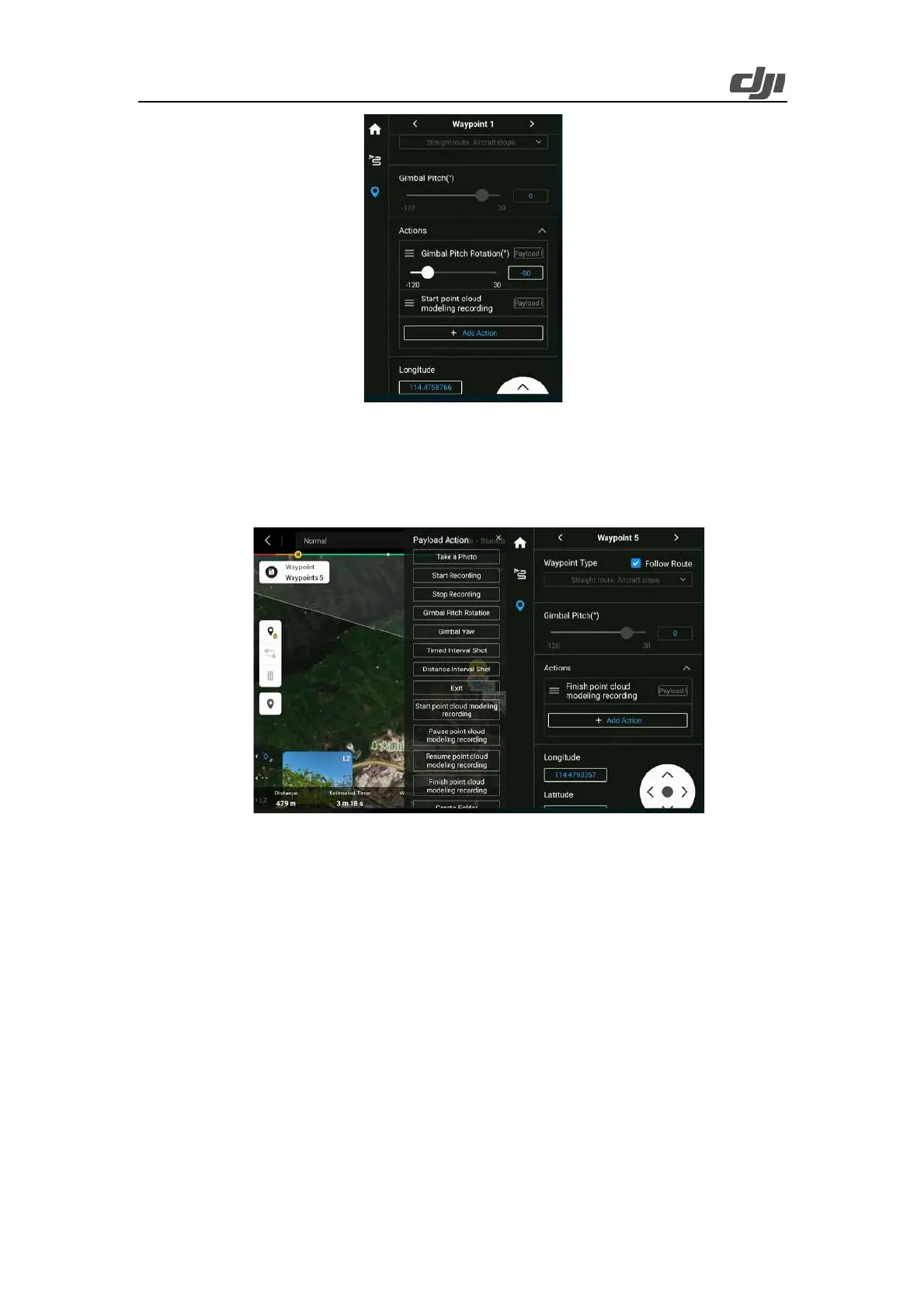
Figure: Parameter settings of the first waypoint
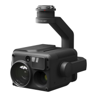
Last waypoint: End the task.
Add Finish point cloud modeling recording as the action at the waypoint.
Select Follow Route for all waypoints' speed, aircraft yaw angle, and waypoint type, and deselect
Follow Route for all waypoints' altitude.
Figure: Parameter settings of the last waypoint
Follow the steps above to collect the coordinates of all waypoints on the route and save the task.
Then, you can export route files in KMZ format to the microSD card for archiving and backup.
KMZ route files archived for backup or from other sources can be imported as follows: Open the
DJI Pilot 2 app, tap Flight Mission, and then select Import Route (KMZ/KML).
3.2.2.2. Manual Flights
The route planning method above has been verified in a large number of applications, which can
cover most power transmission line construction scenarios. Collection of point cloud data by
manually flying aircraft is not recommended. If manual flights are required, pay attention to
parameters such as the flight altitude relative to the tower top and flight speed, and perform regular
IMU calibrations during the flight.