AP1.2 Configuration of NMEA Ver-3.00 Sentence
AP1-18
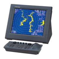
1.2.31 RSD - Radar system data
$RARSD , x.x , x.x , x.x , x.x , x.x , x.x , x.x , x.x , x.x , x.x , x.x , a , a *hh<CR><LF>
1 2 3 4 5 6 7 8 9 10 11 12 13
Contents Data Note
1 Origin 1 range, from own ship
2 Origin 1 bearing, degrees from 0 deg.
Origin 1 and origin 2 are located at the
stated range and bearing from own ship
and provide for two independent sets of
variable range markers (VRM) and
electronic bearing lines (EBL)
originating away from own ship
position.
3 Variable range maker 1(VRM1), range
4 Bearing line 1(EBL1), degrees from 0 deg.
5 Origin 2 range
6 Origin 2 bearing
Origin 1 and origin 2 are located at the
stated range and bearing from own ship
and provide for two independent sets of
variable range markers (VRM) and
electronic bearing lines (EBL)
originating away from own ship
position.
7 VRM2, range
8 EBL2, degrees
9 Cursor range, from own ship
10
Cursor bearing, degrees clockwise from
0 deg.
11 Range scale in use
12 Range units, K/N/S
Radar display
setting data.
13 Display rotation
Display rotation:
C= course-up, course-over-ground up,
degrees true
H= head-up, ship’s heading
(center-line) 0 deg. up
N= north-up, true north is 0 deg. up
1.2.32 TLL - Target latitude and longitude
$--TLL , xx , llll.lll , a , yyyyy.yy , a , c—c , hhmmss.ss , a , a *hh<CR><LF>
1 2 3 4 5 6 7
Contents Data Note
1 Target number 00 - 99
2 Target Latitude, N/S
3 Target Longitude, E/W
4 Target name
5 UTC of data
6 Target status
L= lost, tracked target has been lost
Q= query, target in the process of acquisition
T= tracking
Target number, name,
position and time tag
for use in systems
tracking targets.
7
R= Reference target,
null otherwise
 Loading...