Garmin G1000 Pilot’s Guide for the Piper PA-32 Saratoga
190-02692-00 Rev. A162
FLIGHT MANAGEMENT
SYSTEM
OVERVIEW
FLIGHT
INSTRUMENTS
EIS
AUDIO PANEL
& CNS
FLIGHT
MANAGEMENT
HAZARD
AVOIDANCE
AFCS
ADDITIONAL
FEATURES
APPENDICESINDEX
ADDITIONAL NAVIGATION MAP ITEMS
Navigation maps can display some additional items. Some items can be displayed through the use of the
nearest frequency, map panning, and map measuring functions. Other items (e.g. SVT field of view, track
vector, selected altitude intercept arc, wind vector, and fuel range ring) can be displayed/removed individually
through the MAP SETUP Window option. Refer to the Hazard Avoidance Section for information on displaying
obstacles (Point Obstacle, Wire Obstacle) on the map.
The icons in the following table will be displayed when specific navigation map functions are conducted or
the heading or GPS solution is invalid:
Symbol Name Description Symbol
ARTCC Frequency
or FSS Frequency
Displayed when using the Nearest Frequencies function (see
Audio Panel and CNS Section)
Map Pointer
Displayed when panning (see Using Map Displays in Flight
Management)
Measuring Pointer
Displayed when measuring bearing and distance (see Using Map
Displays in Flight Management)
No heading
aircraft icon
Replaces the normal aircraft icon when aircraft GPS location is
valid, but the heading is invalid.
Dead reckoning
aircraft icon
‘DR’ text displayed over the aircraft icon when the GPS solution
is invalid (see Abnormal Operations in Flight Management)
Table 5-5 Miscellaneous Navigation Map Symbols
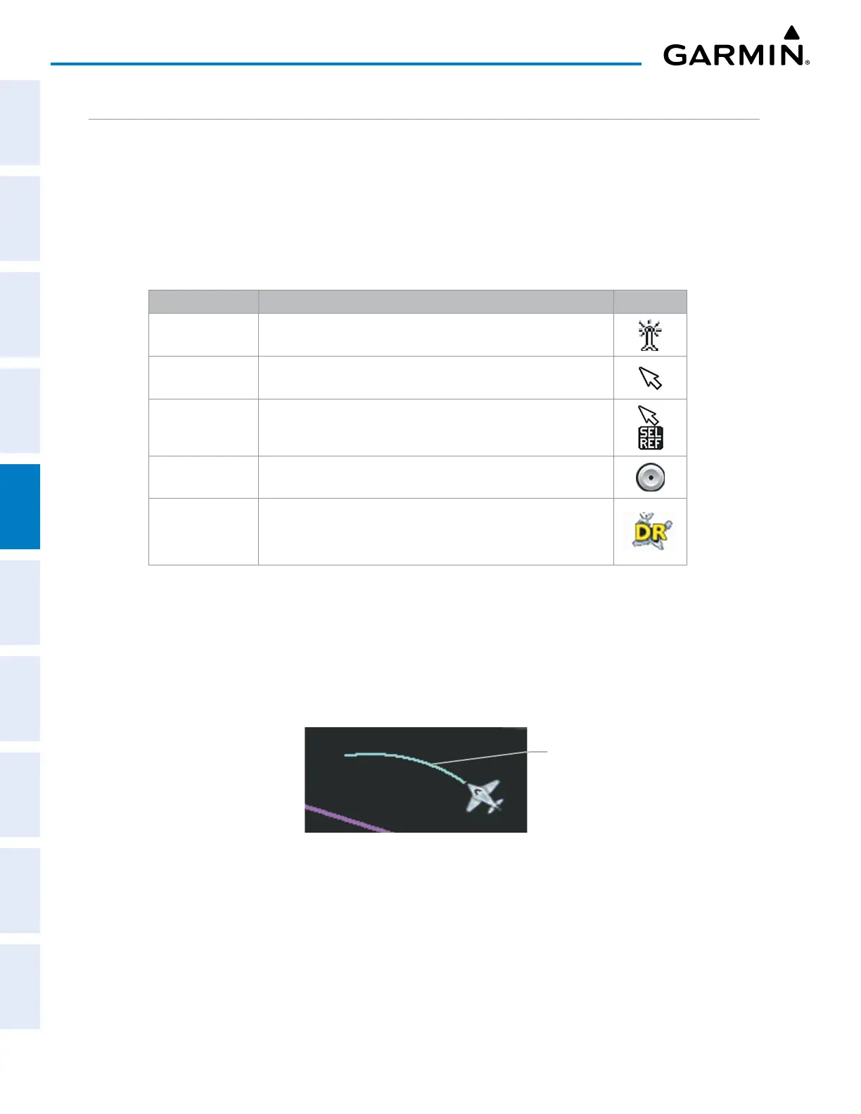
TRACK VECTOR
The Navigation Map can display a track vector that is useful in minimizing track angle error. The track
vector is a solid cyan line segment extended to a predicted location. The track vector look-ahead time is
selectable (30 sec, 60 sec (default), 2 min, 5 min, 10 min, 20 min) and determines the length of the track
vector. The track vector shows up to 90 degrees of a turn for the 30 and 60 second time settings.
Figure 5-18 Navigation Map – Track Vector
Track Vector
Displaying/removing the track vector:
1) Press the MENU Key with the MAP – NAVIGATION MAP Page displayed. The cursor flashes on the ‘Map Setup’
option.
2) Press the ENT Key. The MAP SETUP Window is displayed.
3) Select the ‘Map’ Group.
 Loading...