The rst time you turn on your GPSMAP 580/585, the GPS receiver
must collect satellite data and establish the current location.
Acquiring GPS Satellite Signals
After you turn on the GPSMAP 580/585, the unit automatically
begins searching for satellites. The GPS page appears while the unit
is gathering satellite signals and acquiring a x.
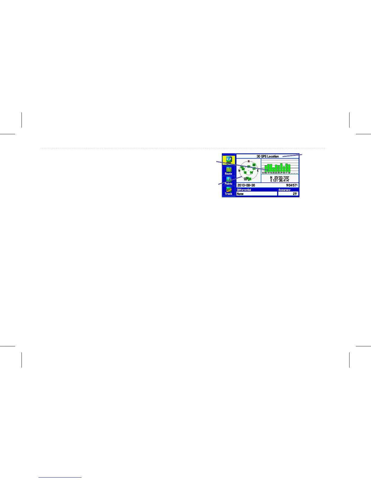
Viewing GPS Status
The GPS tab provides a visual reference of satellite acquisition,
receiver status, and accuracy. The sky view and signal strength
bars show the satellites visible to the receiver and if they are being
tracked.
The number below each bar represents the particular satellite being
received. WAAS satellites are indicated by numbers 33 and above.
Numbers above 33 indicate WAAS satellites.
The sky view shows a bird’s eye view of the position of each
satellite relative to the last known position of the receiver. The outer
circle represents the horizon (north up), the inner circle represents
45º above the horizon, and the cEnter point represents a position
directly overhead. You can also set the sky view to a Track Up
conguration which causes the top of the sky view to display along
your current track heading. Press Menu to change the conguration
of the sky view.
GPS Status
Receiver
status eld
Sky view
Signal
strength bars
4 GPSMAP 580/585 Owner’s Manual
Getting Started