5-16 Pilot’s Guide 190-02327-03 Rev. C
Hazard Awareness
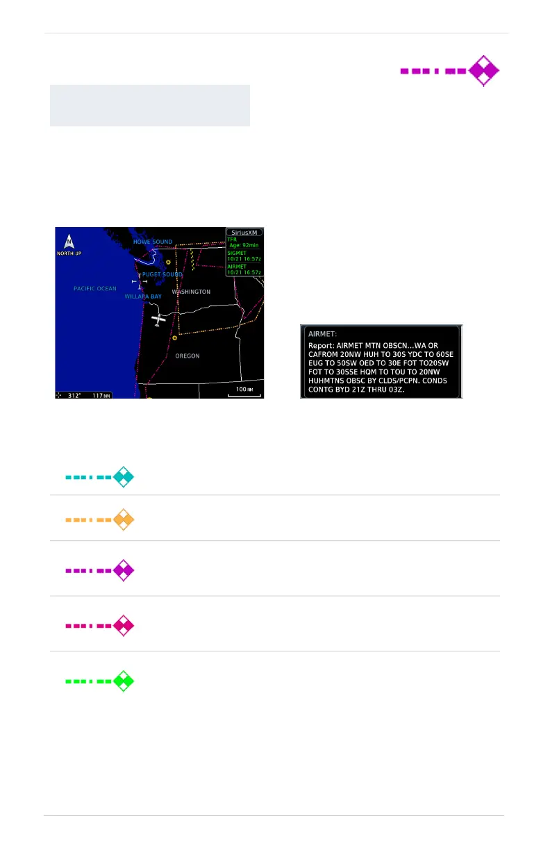
Textual AIRMETs
An AIRMET advises of weather that may be particularly hazardous to single engine,
light aircraft and VFR pilots. Overlays draw the geographical boundaries of received
AIRMETs on the dedicated weather page.
AIRMET TYPES
AVAILABLE WITH:
SIRIUSXM | CONNEXT
Icing
Areas of moderate airframe icing including areal extent.
Turbulence
Areas of moderate turbulence including vertical extent.
IFR
Weather conditions with ceilings <1,000 ft and/or visibility
<3 mi.
MTN OBSR
Widespread mountain obscuration due to clouds, precipitation,
smoke, haze, mist, or fog.
Surface Winds
Sustained surface winds >30 kt and/or potential non-convective
wind shear below 2,000 ft AGL.
SiriusXM Textual AIRMETs
Tapping an AIRMET opens a
detailed report.

 Loading...


