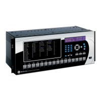
CHAPTER 5: SETTINGS PRODUCT SETUP
D30 LINE DISTANCE PROTECTION SYSTEM – INSTRUCTION MANUAL 5-59
5
Server configuration
The Server Configuration panel contains IEC 61850 settings relevant to the server functions of the IED implementation.
The path is Settings > Product Setup > Communications > IEC 61850 > Server Configuration.
The following settings are available, where <iedName> is a syntactic variable representing the present value of the IED
NAME setting.
IED NAME
Range: 1 to 58 VisibleString characters
Default: TEMPLATE
The value entered sets the IED name used by IEC 61850 for the D30. An IED name unique within the network must be
entered for proper operation. Valid characters are upper and lowercase letters, digits, and the underscore (_) character.
The first character must be a letter.
The IED NAME and the Product LD inst name comprise the <LDName> for a product. The longest LD inst are "Master"
and "System" at six characters, with Master being fixed and the others configurable with the configurable Logical device
feature. So the IED NAME needs to be restricted to 58 characters to meet a 64 character limit.
Location
Range: 0 to 255 ASCII characters
Default: Location
The value entered sets the value of the data attribute <LDName>/LPHD1.PhyNam.location. This data attribute is
provided by the protocol to allow the user to declare where the equipment is installed.
Latitude
Range: -90.000 to 90.000 degrees in steps of 0.001 degree
Default: 0.000 deg
The value entered sets the value of the data attribute <LDName>/LPHD1.PhyNam.latitude. This data attribute is provided
by the protocol to declare the geographical position of the device in WGS84 coordinates -latitude. Negative values
indicate a southern latitude. WGS refers to the world geodetic system, which is used in global positioning systems (GPS),
and 84 is the current version of the standard.
Longitude
Range: -180.000 to 180.000 degrees in steps of 0.001 degree
Default: 0.000 deg
The value entered sets the value of the data attribute <LDName>/LPHD1.PhyNam.longitude. This data attribute is
provided by the protocol to declare the geographical position of the device in WGS84 coordinates -longitude. Negative
values indicate a western longitude.
Altitude
Range: 0 to 10,0000 m in steps of 1 m
Default: 0 m
The value entered sets the value of the data attribute <LDName>/LPHD1.PhyNam.altitude. This data attribute is provided
by the protocol to declare the geographical position of the device in WGS84 coordinates - altitude.
Prefix for GGIO1
Range: 0 to 11 VisibleString characters
Default:
This setting sets the LN Prefix of the FlexLogic operand interface logical node GGIO1 that is described in the GGIO1
section later. Valid characters are upper and lowercase letters, digits, and the underscore (_) character. The first
character must be a letter. UR Setup software does not allow entry of a prefix that duplicates any other GGIO1 prefix
that is used by the product, such as ConIn and ConOut.