109
AutoChart LIVE
AUTOCHART LIVE OVERVIEW
A
utoChart LIVE uses data from an installed GPS receiver and 2D transducer (down beam, DualBeam PLUS) to create detailed depth
m
aps of your favorite waters.
Map Source: Humminbird LakeMaster or Navionics
Storage: AutoChart LIVE saves 8 hours of mapping data on your control head. After 8 hours of data has been collected, you can
erase the data and continue mapping, or you can purchase a ZeroLine Map Card for unlimited mapping.
ZeroLine Map Card: To purchase a ZeroLine Map Card and download the accessory guide, visit our Web site at humminbird.com.
More Information: Visit our Web site for informational videos.
PLAN YOUR MAP
Before getting started, consider the areas where you want to create a map. Review the following tips to help you plan your map:
General Tips
• Start with your favorite fishing hot spots. It is not recommended to record survey data of an entire lake, as it will require a lot
of time to map and might include areas you don’t want.
• Take a different route to and from each fishing spot every trip. You may discover new and interesting areas to map.
• Start a new track or recording when you start for the day. Record new data every trip to create new maps or improve existing maps.
• Navigate the boat at a consistent speed when recording data.
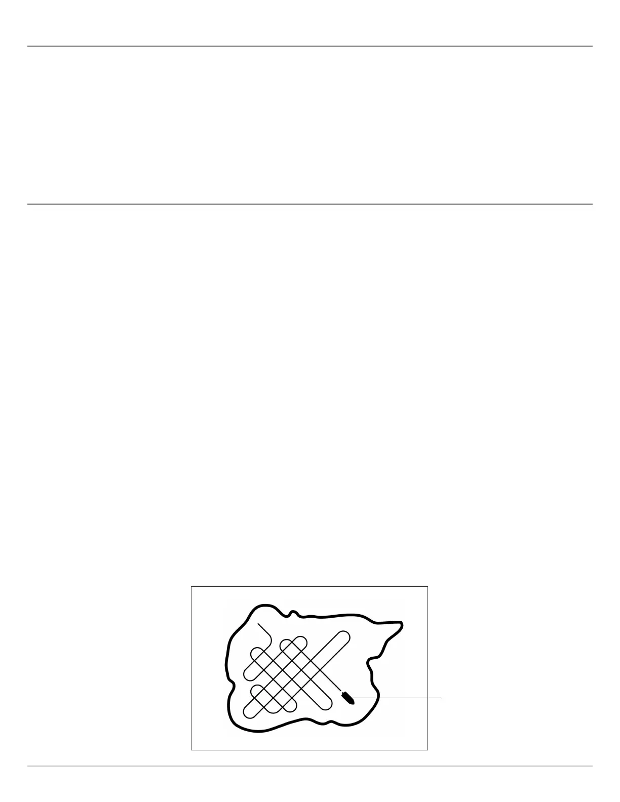
• See the illustration below for instruction on how to navigate your boat while recording survey data.
Mapping a Specific Area or Object in Detail
• Navigate the boat across the area rather than alongside.
• Turn the boat where the area and/or object is out of range of the transducer beam(s).
• Try to reduce the measurement time, so as to reduce the error due to possible GPS variations.
Mapping an Entire Lake
• Follow a plan.
• Follow the maximum gradient of the sea floor (up or down).
• Keep a steady speed. Trolling speeds to low speeds are recommended.
• Turn the boat where the bottom is flat if possible.
Navigating the Boat to Record Survey Data
Navigate your boat in a
zig-zag pattern, first in
one direction and then
in the other.
 Loading...