Marine Systems
Aviation Recorders
Rev. 02 Page 2--7
July 29/03
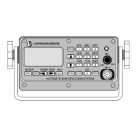
Automatic Identification System
Displays ID, Range, and Bearing of nearest three (3) vessels sorted by range, clos-
est first. This is the default display screen and accessed from anywhere within the
menu system by pressing the NAV key. As the default screen, it will display automat-
ically after 10 seconds of inactivity on any other screen. Each vessel will be dis-
played using their MMSI if the ship name is not know, and the user can toggle be-
tween MMSI and Shipname using LEFT or RIGHT arrow keys.
O
MM
Na
SI
me
PS
N
rc
XX
Hd
CO
g:
G:
wn S
:0
:L
00
3
:I
° X
nt
X.
XX
XX
X °
.X
hi p
00
EX
00
AM
U
XX
nc
XX
°
I
0
P
o
nf or
0
LE
Na
rr
WXX
RO
SO
T:
G:
ma t i
vS: U
PA
° X
:0
X.
X °
0. 0
on
NDFN
R
XX
F:
XX
Kn
D
0
Figure 2--3. Own Ship Data Display
Display navigational information for own--ship and configuration details. This is ac-
cessed by the sequence FNC ENT. The data that is displayed is as follows:
MMSI Maritime Mobile Service ID
NavS Navigational Status
Options:
Underway
At Anchor
Name Shipname
Psrc Positional Data Source
PA Positional Accuracy
Options:
0 = External DGNSS in use (corrected)
1 = Internal DGNSS in use (corrected, message 17)
2 = Internal DGNSS in use (corrected, beacon)
3 = External EPFS in use (uncorrected)
4 = Internal GNSS in use (uncorrected)
5 = No sensor position in use
RF RAIM Flag (receiver autonomous integrity monitoring, check GPS status)