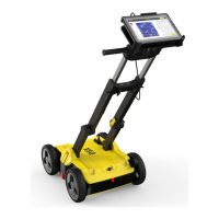
5 Planning a Survey
To carry out a survey with the DSX in the most efcient way, gather all avail-
able information before each project:
•
Make yourself familiar with the jobsite features.
•
Obtain technical maps, recommended in DXF format, about existing utilit-
ies on the jobsite.
•
Supplement the acquired scan data by opening manholes on-site.
☞
Be cautious when performing site investigation and make sure to
adhere to local laws for safety.
The basic requirement for carrying out a survey is understanding the features
of the jobsite. When gathering information about the jobsite, keep in mind the
objectives of the survey. Consider the following points when preparing the
survey:
•
Do you need any specic permissions to carry out the survey on the job-
site, for example, access permission to pedestrian zones or permission to
interrupt the trafc ow?
•
Are there any difculties in accessing the jobsite? (Available space, any
architectural features forming an obstacle, etc.).
•
Is the jobsite in an area with a high level of urban trafc, such as streets,
squares or pavements? Are there parked cars that could be in the way
during the survey?
Technical maps of existing utilities are normally created by public utility com-
panies. Such maps give a schematic overview about the type and position of
utilities that are constructed and managed by the public utility companies.
Even if these maps are generic, they can give a rst impression of the existing
utilities and provide additional information during the data acquisition and
interpretation phase.
☞
To obtain technical maps of the jobsite, contact the cartographic or
planning ofce of the different utility companies. Clearly specify the
streets and areas of interest. Request the maps early enough in
advance to the survey, to ensure that the maps are available for the
data acquisition phase.
The following list contains the most important types of utilities that need to
be considered:
•
Street lights
•
Low, medium and high-voltage electricity cables
•
Telephone cables
•
Gas pipes
•
Water supply pipes
•
Sewage pipes
Once data acquisition is complete, opening the manholes on-site can provide
you with further information regarding depth, diameter and direction of the
utility. This information serves as reference data during the interpretation
phase.
Jobsite Investigation
Jobsite Features
Technical Maps of
existing utilities
Opening manholes
Planning a Survey 43