40
(e.g., time, language, system of measurement, see
page 57), configure your map (e.g., 2D or 3D mode,
day or night mode) or load a map of a different region
(see page 58), set the route options (e.g., choose to
avoid or allow toll roads or ferries or select your mode
of transportation; see page 57) or adjust the volume
(see page 62).
Map
The map is the core component of your Personal Navigation
Device. It is centered on your current location by default,
provided you have a GPS connection. You can browse the
map, display information about the different locations shown
on it and choose them for routing and navigating.
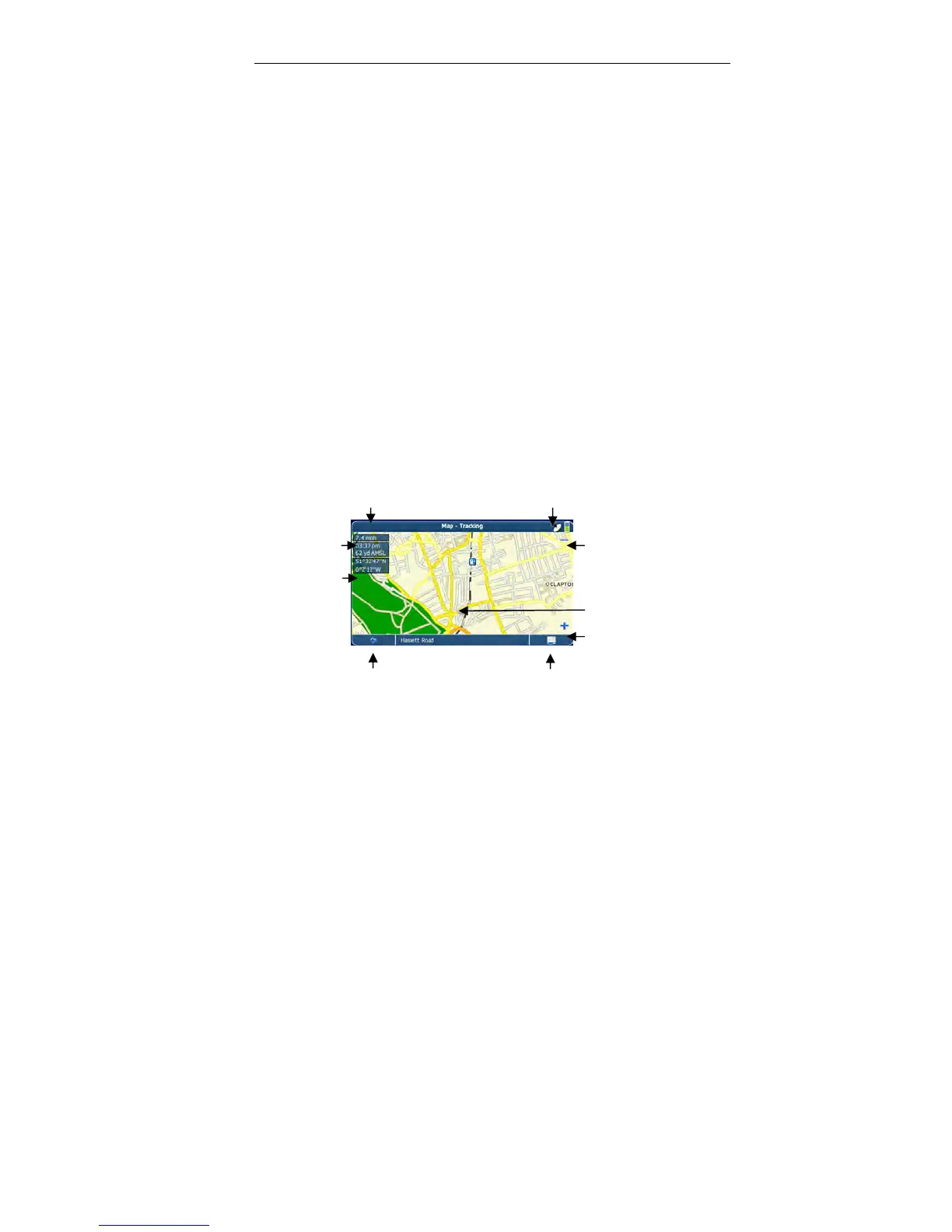
Tracking mode and browsing mode
The map has two basic states: tracking and browsing.
In the tracking mode, the map follows your actual position
(GPS position), displaying information about your geographic
position, your speed, etc.
Speed GPS status
Battery status
Time
Zoom out
Elevation
above mean
sea level
Geographic
coordinates GPS position
Zoom in
Back icon Menu icon
 Loading...