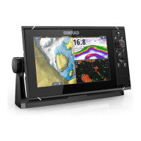
Charts
The chart function displays your vessel’s position relative to land
and other chart objects. On the chart panel you can plan and
navigate routes, place waypoints, and display AIS targets.
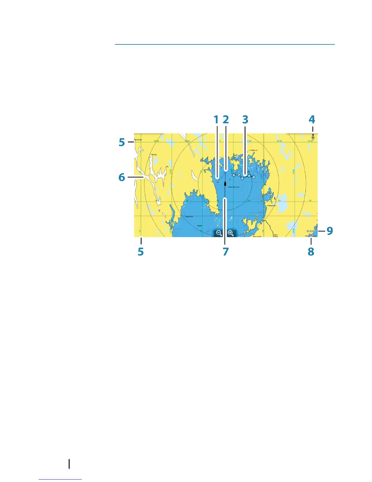
The Chart panel
1 Waypoint*
2 Vessel with extension line (extension line is optional)
3 Route*
4 North indicator
5 Grid lines*
6 Range rings*
7 Track*
8 Chart range scale
9 Range rings interval (only displayed when Range rings are
turned on)
* Optional chart items. You turn the optional chart items on/off
individually from the Chart settings dialog.
3
14
Charts | GO XSE Getting Started
 Loading...