Do you have a question about the Simrad NSO evo3S MPU and is the answer not in the manual?
Describes access to the Home page and its main elements like buttons and bars.
Instructions on how to power the system on, off, and enter standby mode.
Describes the elements and indicators displayed on the chart panel.
Describes the SAR feature for creating search patterns on the chart.
Details C-MAP specific chart options and features like tides and currents.
Information on Navionics features, data requirements, and specific chart options.
Access to advanced edit functions and settings for user-defined items.
Explains routes as a series of routepoints for navigation.
Describes tracks as historical path presentations and their conversion to routes.
Describes the Nav panel and its role in displaying navigation information.
Details the elements and data fields shown on the Nav panel.
Guide on setting the autopilot to navigation mode for automated steering.
Details the trip statistics available on the Information tab.
Introduces radar support and menu options dependent on connected sensors.
Describes the visual elements and indicators of the Radar panel.
Explains connecting and viewing images from two supported radars simultaneously.
How to overlay radar images on charts for target correlation.
Covers advanced settings like Noise Rejection and Target expansion.
Defines an area for alarms when targets enter or exit the zone.
Details the MARPA function for tracking up to ten radar targets.
Introduces AIS for displaying and tracking targets and DSC transmitting devices.
Explains the functionality and reception of AIS SART signals.
Sets CPA and TCPA values to define when a target is considered dangerous.
Describes the echosounder function and transducer connections.
Configuration and setup options for the echosounder system.
Introduces SideScan for detailed seabed imaging to the sides of the boat.
Describes the elements and range scales of the SideScan panel.
Provides detailed images of structure and fish directly below the vessel.
Describes the DownScan panel and its zoom capabilities.
Guides on setting up the DownScan image via Source, Range, and Contrast.
Introduces 3D Sonar for multi-beam sonar technology and 3D views.
Describes the elements of the 3D panel showing real-time sea floor imaging.
Guides on setting up the 3D image via Source, Range, and Contrast.
Feature for overlaying SideScan images on charts for underwater environment visualization.
Describes how StructureMap is displayed as an overlay on the chart panel.
Navigational aid for monitoring underwater environment during slow speed maneuvers.
Describes the elements of the ForwardScan image.
Guides on setting up the ForwardScan image via Source and Range settings.
User-selected thresholds defining a critical zone forward of the vessel.
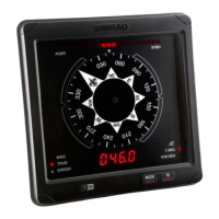
Using the MFD to operate a connected professional autopilot system.
Controls trolling motor speed via propeller rate or cruise control.
Essential safety guidelines and warnings for operating the outboard autopilot.
How to select and activate the outboard autopilot.
Details various steering modes for outboard autopilots.
Used for navigating routes or waypoints in open waters.
How to activate or deactivate applications via system settings.
Guide on creating a custom dashboard from scratch or templates.
Guides on selecting video source, standard, and adjusting image settings.
Describes control buttons, tools, and options for audio sources.
Information on controlling SiriusXM radio service in North America.
Allows viewing forecast data overlaid on charts for weather understanding.
Details SiriusXM weather service availability and features.
Setup for lightning, storm, or severe weather forecast alarms.
States the need for an external WiFi module for internet and device connectivity.
| Video Output | 2 x HDMI |
|---|---|
| Connectivity | Wi-Fi, Bluetooth |
| Operating System | Linux |
| Ethernet Ports | 2 |
| USB Ports | 2 |
| Operating Voltage | 12/24V DC |
| Power Supply | 12/24V |