Do you have a question about the Simrad NSS9 evo3S and is the answer not in the manual?
States Navico's right to change products and user responsibility for safe use.
English language version is official in case of translation conflicts.
Lists registered trademarks used in the manual.
Lists Navico products mentioned in this manual.
States that the declaration of conformity is available online.
Declares product conformity with European requirements.
Declares product conformity with US FCC Rules.
Declares product conformity with ISED Canada regulations.
Declares product conformity with AUS/NZ standards.
Explains the manual's purpose and assumptions.
Explains text conventions like Note and Warning.
Mentions the manual's software version.
Provides information on translated manual availability.
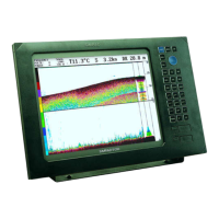
Describes the function of each physical button on the unit.
Explains the usage of the memory card slot.
Details the elements and layout of the Home page.
Accesses application and feature settings dialogs.
Provides access to non-panel specific options and tools.
Shows the status of the system and definitions of status icons.
Allows opening applications and predefined split pages.
Feature for controlling multiple displays simultaneously.
Provides quick access to basic system settings.
Lists and allows editing of preconfigured and user-made favorite pages.
Procedure for creating a Man Overboard waypoint.
Describes application panels and their customization.
Shows how to display multiple application pages on one panel.
Instructions for powering the unit on and off.
Details the initial setup dialogs upon first use or reset.
Refers to the Appendix for detailed operation instructions.
Information on connecting and using remote controllers.
Provides quick access to basic system settings.
How to select and activate system functions.
Explains the power-saving standby mode.
Adjusting the display backlight levels.
Optimizes the color palette for low light conditions.
Prevents accidental operation of the touchscreen.
Toggles the instrument bar on/off for the current page.
Guides on how to register your device.
Instructions for taking a screenshot.
Allows selection of custom pictures for the Home page background.
Configures the action of the WheelKey on the unit.
Specifies actions for long press on panel buttons.
Details on adjusting panel sizes in multi-panel pages.
Explains cursor behavior on sonar/chart panels in split view.
Instructions for adding and editing favorite pages.
Details on configuring the instrument bar display.
Overview of controlling multiple displays simultaneously.
Steps to add displays to a bridge configuration.
Setting up page configurations (presets) for bridge displays.
Displays an overview of available bridge presets.
Identifies elements within the chart panel.
Information on system cartography and chart sharing.
How to choose between available chart data sources.
Enables displaying two different chart sources simultaneously.
Explains the meaning of the vessel symbol on the chart.
Adjusting the chart scale by zooming in or out.
Describes how to move the chart in any direction.
Specifies how the chart is rotated in the panel.
Maximizes view ahead of the vessel on the chart.
Shows basic and detailed information for chart items.
Guides on activating and using the chart cursor.
Allows fine-tuning and precision placement of the cursor.
How to measure distances between points on the chart.
Step-by-step guide to creating new routes.
Search functionality for vessels and chart items.
Creates search patterns for SAR operations.
Provides a three-dimensional graphical view of the chart.
Describes how to move the 3D chart view.
How to control the view angle of 3D charts.
Opens the Tracks dialog for managing tracks.
How to color tracks based on data and limits.
Enables adding various overlays on the chart panel.
Details C-MAP specific chart options and features.
Displays C-MAP tide and current prediction data.
Options specific to C-MAP charts like photo overlay.
Changes the view to that of a traditional paper chart.
Enables higher concentration of contour lines.
Sets the level of detail displayed on the chart.
Allows turning chart categories and sub-categories on/off.
Shades the seabed terrain for better visualization.
Removes contour lines from the chart display.
Controls the depth palette used on the map.
Shades different areas of the seabed.
Graphical settings for 3D mode to enhance depth visualization.
Displays high-resolution contours from Genesis users.
Requirements for using Navionics charts.
Specific chart options for Navionics charts.
Adds terrain information to the chart.
Highlights depth ranges for fishing purposes.
Highlights areas of shallow water.
Navionics chart safety depth settings.
Supports Navionics SonarChart feature for bathymetry maps.
Real-time depth contour overlay from live sonar.
Used for selecting the image's color palette.
Displays different depth areas in shades of blue.
Shows tides and currents with gauges and arrows.
Hides rock identification on charts beneath a given depth.
Determines contours shown down to safety depth value.
Displays chart information symbols and wording.
Determines area information available for display.
Provides different levels of geographical layer information.
Magnifies chart items and text.
General settings for chart display and options.
Determines the icon used on 3D charts.
Presents distance from vessel to other objects.
Sets lengths of heading and course extension lines.
ForwardScan heading extension on chart.
Adjusts SonarChart Live depths using tide station info.
Links positions shown on 2D and 3D charts.
Determines if basic info is displayed when selecting panel items.
Turns on/off viewing of longitude and latitude grid lines.
Turns on/off displaying navigation items on charts.
Access advanced edit functions for waypoints, routes, and tracks.
Opens the Plot dialog to manage navigation items.
Details about user-generated marks (waypoint) on the system.
Procedure for saving a waypoint at cursor or vessel position.
Repositioning a waypoint on the panel.
Allows editing all information about a waypoint.
Procedure for deleting waypoints.
Setting alarm radius for individual waypoints.
Details about creating and managing routes.
Step-by-step guide to creating a new route.
Allows editing an active route on the chart panel.
Method for creating routes from existing waypoints.
Creating routes from historical trip data.
Converts a recorded track into a route.
Automated route planning based on boat and map data.
Manages routes and routepoints, and changes route properties.
Procedure for deleting routes.
Details about tracks and their management.
Explains tracks as a graphical presentation of the vessel's path.
System automatically tracks and draws vessel's movement.
Details on starting, recording, and displaying tracks.
How to start a new track recording.
Manages tracks and changes track properties.
Options for coloring tracks based on data or settings.
Procedure for deleting tracks.
Configures how track points are positioned.
Accessing and managing C-MAP Embark data.
Synchronizes data between unit and C-MAP Embark.
Overview of the navigation function.
Details about navigation panels and their elements.
Identifies elements within the navigation panel.
Explains switching between Navigation and Position panels.
Menu options available during navigation.
How to set autopilot for navigation mode.
Configuration options for navigation.
Sets an invisible circle around destination waypoints.
Defines deviation limit from route; triggers alarm.
Activates alarm when reaching a waypoint or arrival radius.
Settings for magnetic north variation.
Sets the datum format for cartography and navigation.
Sets the geographic coordinate system used.
Enables use of Phantom Loran positioning system.
Overview of storing and recalling trip information.
Displays current trip statistics like distance and speed.
Feature for automatic trip detection and recording.
Manually starting and stopping trip recordings.
View seasonal trip information.
Allows adjusting the total trip distance statistic.
Resets the fuel economy gauge on the instrument bar.
Estimates total distance the boat can travel on remaining fuel.
Displays fuel level and consumption.
Records refueling events for accurate fuel calculations.
Displays tide height at selected stations.
Accesses and views recorded trip history.
Overview of supported radar sensors and features.
Identifies elements within the radar panel.
Allows connecting and viewing two supported radars simultaneously.
How to specify the radar source for a panel.
Overlays radar image on chart for target correlation.
Choose radar source for overlays on chart panels.
Details the radar modes: Power off, Standby, Transmit.
Adjusts the radar range using zoom icons.
Utilizes radar's dual range capability.
Defines sectors on the PPI to blank out interference.
Tips for improving radar image quality.
Utilizes preset control settings for different environments.
Reduces clutter for better visibility of smaller vessels.
Controls the sensitivity of the radar receiver.
Filters the effect of random echo returns from waves.
Reduces effect of rain, snow, or weather conditions.
Guides on activating and using the radar cursor.
Accesses advanced settings for radar.
Sets required signal strength for radar returns.
Increases target length for easier visibility.
Reduces interference from other radar units.
Controls target discrimination for better object separation.
Sets antenna rotation speed for faster target updates.
Controls sea state for optimal sea clutter rejection.
Enhances target visibility by increasing size and sensitivity.
Provides various view options for radar display.
Distinguishes moving targets using Doppler coloring.
Sets speed thresholds for coloring targets.
Illustrates VelocityTrack behavior in navigation scenarios.
Defines optional radar items to be turned on/off.
Sets duration for target trails and options to turn them off.
Temporarily clears target trails from the radar panel.
Different color palettes for representing radar details.
Indicates radar orientation: Heading UP, North UP, Course UP.
Displays radar image relative to own ship's heading.
Displays chart with North upward.
Displays chart with vessel's course line upward.
Indicates True motion or Relative motion.
Own vessel fixed, other objects move relative to position.
Vessel and targets move across the PPI.
Sets the antenna position origin on the radar PPI.
Tools for measuring range and bearing to targets.
Procedure for positioning EBL/VRM markers.
Using the cursor to place EBL/VRM markers.
Adjusting the offset position of an EBL/VRM marker.
Defines a zone that alerts on target entry or exit.
Configures alarms for guard zone breaches.
Adjusts guard zone sensitivity to eliminate small target alarms.
Mini Automatic Radar Plotting Aid for tracking targets.
Defines symbols used for MARPA targets.
Procedure for acquiring and tracking MARPA targets.
Options for cancelling MARPA target tracking.
Displays detailed information for MARPA targets.
Configures MARPA alarms for lost or unavailable targets.
Records radar data to internal memory or storage.
General settings for radar display and options.
Selects optional radar items to display.
Settings for MARPA history length and safe ring.
Overview of the Automatic Identification System.
How to select an AIS target icon.
Finds AIS targets around cursor or vessel position.
Shows status and information for vessel types.
Displays a list of all targets and received AIS messages.
Provides detailed information about an AIS target.
Displays AIS target information on radar panels.
Initiates DSC calls to other vessels.
Requests/receives position data from DSC VHF radio.
Handles AIS SART signals from rescue transponders.
Details AIS SART alarm messages and options.
Defines alarms for target proximity or loss.
Defines symbols used for AIS targets.
Used for entering own MMSI number for AIS/DSC messages.
Filters AIS icons based on security, distance, or speed.
Defines length of course/heading extension lines.
Sets CPA/TCPA values to define dangerous targets.
Overview of the echosounder function.
States the need for a compatible echosounder transducer.
Identifies elements within the echosounder image.
Specifies how to select echosounder sources.
Allows zooming the echosounder image.
Displays and controls zoom level vertically.
Guides on activating and using the echosounder cursor.
View echosounder history using the history bar.
Starts recording echosounder log data.
Stops recording echosounder log data.
Reviews internally/externally stored sounder records.
How to upload sonar logs to C-MAP Genesis.
Options for customizing the echosounder image display.
Determines water depth visible on the screen.
Manually selects a preset range level.
Automatically displays the whole range from surface to bottom.
Details supported transducer frequencies.
Controls the sensitivity of the echosounder.
Adjusts echo signal colors for display.
Specifies the source for the image in the active panel.
Measures distance between two observations on the image.
Accesses advanced settings for echosounder.
Controls the rate the transducer transmits signals.
Echosounder split screen display modes.
Magnifies the sounder image using zoom bars.
Mode for viewing targets close to the bottom.
Used for selecting the image's color palette.
Illustrates changes in water temperature.
Shows a line on the bottom surface for distinction.
Displays echo sounding strength via width and color.
Explains display modes for amplitude scope.
Overview of SideScan for detailed seabed imaging.
Identifies elements within the SideScan panel.
Allows zooming the SideScan image.
Guides on activating and using the SideScan cursor.
View SideScan history by panning the image.
Records SideScan data to log files.
Options for configuring the SideScan image display.
Specifies the source for the SideScan image.
Determines distance left and right of the center.
Manually selects a preset range level.
Automatically displays the whole range from surface to bottom.
Details supported SideScan frequencies.
Determines brightness ratio between light and dark areas.
Used for selecting the image's color palette.
Specifies display of left side, right side, or both.
Accesses advanced settings for SideScan.
Overview of DownScan for detailed structure and fish imaging.
Identifies elements within the DownScan panel.
Allows zooming the DownScan image.
Guides on activating and using the DownScan cursor.
View DownScan history by panning the image.
Records DownScan data to log files.
Options for configuring the DownScan image display.
Determines water depth visible on the screen.
Manually selects a preset range level.
Automatically displays the whole range from surface to bottom.
Manually sets upper and lower range limits.
Details supported DownScan frequencies.
Determines brightness ratio between light and dark areas.
Used for selecting the image's color palette.
Displays fish arches in the DownScan image.
Controls sensitivity of FishReveal data.
Adjusts fish arch colors for differentiation.
Reduces surface clutter by decreasing receiver sensitivity.
Selects palettes optimized for fishing conditions.
Accesses advanced settings for DownScan.
Overview of multi-beam sonar for underwater visualization.
States need for 3D Sonar capable transducer and module.
Identifies elements within the 3D Sonar panel.
Allows zooming the 3D Sonar image.
Guides on activating and using the 3D Sonar cursor.
Procedure for saving waypoints in 3D view.
Details Vessel mode vs Cursor mode.
Vessel mode: view locked to vessel, camera rotatable.
Cursor mode: image static, camera rotatable and zoomable.
Displays fish clusters with color corresponding to intensity.
View 3D Sonar image history using the history bar.
Options for configuring the 3D Sonar image display.
Specifies the source for the 3D Sonar image.
Determines distance left and right of the center.
Manually selects a preset range level.
Automatically displays the whole range from surface to bottom.
Details supported 3D Sonar frequencies.
Determines brightness ratio between light and dark areas.
Used for selecting the image's color palette.
Accesses advanced settings for 3D Sonar.
Pauses the 3D Sonar image for examination.
Clears existing live history data from the screen.
Maintains set relative rotation from the vessel.
Highlights specified depth ranges on the display.
Overview of overlaying SideScan images on charts.
Describes how StructureMap is displayed on the chart panel.
Explains sources: Live data and Saved files.
Uses live SideScan imaging history as a trail.
Reviews saved StructureMap files.
Provides tips for using StructureMap effectively.
Using StructureMap with third-party charting cards.
Accesses settings menu for StructureMap overlay.
Sets the search range for StructureMap.
Sets the opaqueness of the Structure overlay.
Used for selecting the image's color palette.
Determines brightness ratio between light and dark areas.
Shows/hides the water column in Live mode.
Details supported StructureMap frequencies.
Clears existing live history data from the screen.
Displays the log sonar dialog.
Determines the StructureMap source displayed.
Overview of ForwardScan sonar as a navigational aid.
Identifies elements within the ForwardScan image.
Options for configuring the ForwardScan image display.
Specifies the source for the ForwardScan image.
Controls the depth range setting.
Controls the forward looking search range.
Filters out signal interference and reduces clutter.
Displays warning and critical zones on screen.
Accesses additional ForwardScan options.
Monitors ForwardScan on chart using heading extension.
Configures the ForwardScan heading extension on the chart panel.
Specifies setup in the ForwardScan installation dialog.
Defines thresholds for critical zones forward of the vessel.
Defines thresholds for warning zones shown on image.
Fine-tunes transducer angle if not parallel to waterline.
Adjusts depth readings to account for transducer position.
Guidelines for safe operation of the autopilot system.
Recommendations for enabling all autopilot alarms.
How to activate an autopilot system.
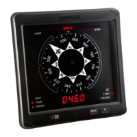
Overview of the autopilot controller interface.
Procedure for engaging and disengaging the autopilot.
Shows autopilot information in the status bar.
Overview of various autopilot steering modes.
Steers vessel on a set heading.
Steers vessel along a calculated track line.
Warning regarding use of NAV mode in open waters.
Buttons available in NAV mode on autopilot controller.
Handles course changes to next waypoint in NAV mode.
Autopilot steers based on current wind angle.
System includes automatic turn steering features.
Procedure for starting an automatic turn.
Adjustable settings for turn patterns.
Changes current heading by 180 degrees.
Steers the vessel in a circle.
Makes the vessel turn in a spiral.
Steers the vessel in a zigzag pattern.
Steers the vessel in a square pattern.
Makes the vessel yaw around the main heading.
Autopilot follows a depth contour.
Details variables for Depth Contour Tracking.
Operating an external autopilot system via MFD.
Using the same source groups as the professional autopilot.
Controller with additional buttons for professional autopilots.
Controls thruster availability and status.
Chooses from different autopilot work profiles.
General settings for autopilot computers.
User settings common to all autopilots.
Displays a compass symbol around the boat on the chart.
User settings specific to NAC-1 autopilot.
Adjusts steering sensitivity and rudder activity.
User settings specific to NAC-2/NAC-3 autopilots.
Adjusting low and high speed steering parameters.
Manually changing sailing parameters.
User settings specific to AC70/AC80 computers.
Guidelines for safe operation of trolling motor autopilot.
Recommendations for enabling autopilot alarms.
How to activate the trolling motor autopilot.
Overview of the trolling motor autopilot controller.
Procedure for engaging and disengaging the trolling motor autopilot.
Shows autopilot status.
Overview of trolling motor autopilot steering modes.
Maintains vessel position using anchor modes.
Repositioning the vessel while in anchor mode.
Steers vessel on the set heading.
Warning regarding use of NAV mode in open waters.
Buttons available in NAV mode on controller.
System includes automatic turn steering features.
Procedure for starting an automatic turn.
Adjustable settings for turn patterns.
Changes current heading by 180 degrees.
Steers the vessel in a circle.
Makes the vessel turn in a spiral.
Steers the vessel in a zigzag pattern.
Steers the vessel in a square pattern.
Makes the vessel yaw around the main heading.
Controls trolling motor speed in various modes.
Saving tracks from the autopilot controller.
General settings for trolling motor autopilot.
Displays a compass symbol around the boat on the chart.
Selects if autopilot controls trolling or outboard motor.
Controls visibility of the autopilot bar when in standby.
Switches from navigation to selected arrival mode.
Disengages the autopilot.
Locks and maintains the last vessel heading.
Anchors the vessel at the destination point.
Stores and displays anchor points.
Configure action keys on the trolling motor foot pedal.
Guidelines for safe operation of outboard autopilot.
Recommendations for enabling autopilot alarms.
How to activate the outboard autopilot.
Overview of the outboard autopilot controller.
Procedure for engaging and disengaging the autopilot.
Shows autopilot status in the status bar.
Overview of outboard autopilot steering modes.
NFU mode operation using port/starboard buttons.
Steers vessel on a set heading.
Steers vessel along a calculated track line.
Warning regarding use of NAV mode in open waters.
Buttons available in NAV mode on controller.
Handles course changes to next waypoint in NAV mode.
System includes automatic turn steering features.
Adjustable settings for turn patterns.
Changes current heading by 180 degrees.
Autopilot follows a depth contour.
Details variables for Depth Contour Tracking.
General settings for outboard autopilot.
Displays a compass symbol around the boat on the chart.
Selects if autopilot controls trolling or outboard motor.
Provides automatic and manual data source selection.
Controls visibility of the autopilot bar when in standby.
Calibrates boat steering with the NAC-1.
Adjusts steering sensitivity and rudder activity.
Overview of instrument panels and gauges.
Steps to create a custom dashboard.
Creates a dashboard from scratch.
Copies an existing dashboard layout.
Uses pre-defined templates to create dashboards.
Allows editing gauges, limits, and layout of dashboards.
Selects and positions gauges on the dashboard.
Explains keyboard operation for adding gauges.
Selects the data to be shown on a gauge.
Switching between different dashboard views.
Overview of the video function for viewing sources.
Describes the proportional scaling of video images.
Configuration options for the video panel.
Selects single or cycles through available video sources.
Video source specific menu options.
Overview of controlling the vessel's audio system.
Details buttons, tools, and options for audio sources.
Steps for setting up the audio system.
Selects the device as the audio server.
Details on setting up audio zones and speaker controls.
Controls different audio zones individually.
Adjusts volume for all speaker zones.
Displays list of available audio sources.
Pairs audio server with Bluetooth enabled devices.
Instructions for tuning and saving AM/FM radio channels.
Options for displaying Sirius channels.
Creates favorite channels from Sirius lists.
How to select a Sirius channel.
Locks selected Sirius channels from broadcasting.
Controls DVD player when audio source is set to DVD.
Matches video format to display connected to Audio server.
Overview of weather functionality for forecast overlays.
Explains wind direction and speed indicators.
Displays detailed weather observation information.
Information on GRIB weather forecast files.
How to import GRIB files into memory.
How to display GRIB data as an overlay on the chart.
Shows date, time, and forecast details.
Animates past or future weather conditions.
Overview of SiriusXM marine weather information.
Displays signal strength and status of weather module.
Displays Sirius weather as an overlay on the chart panel.
Shows current weather and forecast for current location.
General display options for weather data.
Options for displaying precipitation, SST, and wave height.
Explains color shading for precipitation type and intensity.
Options for displaying SST as color shading or text.
Colors used to indicate forecast wave height.
Turns surface features like fronts and isobars on/off.
Turns cloud tops display on/off.
Turns echo tops display on/off.
Shows weather condition icons and their meanings.
Accesses weather reports for US/Canadian marine zones.
Read tropical statements about weather conditions.
Define SST range and wave height color coding.
Animates past or future weather conditions.
Adjusts the transparency of the overlay.
Setup alarms for lightning, storms, or watchboxes.
Features using internet for data downloads and uploads.
Automatic connection to internet via Ethernet.
Use WiFi for internet access and connecting wireless devices.
Configuration and setup options for wireless functionality.
Connects to a hotspot with internet access.
Connects a phone or tablet to the MFD.
Enables built-in Bluetooth functionality.
Dialog for pairing or removing Bluetooth devices.
Enables or disables the internal WiFi.
Shows WiFi network connection status.
Displays MFD's hotspot network name and key.
Displays hotspots the unit has connected to.
Manages wireless devices connected to the unit.
Dialog showing available wireless devices.
Tools for fault-finding and setting up wireless networks.
Available options for remotely controlling the MFD.
Using phones and tablets for remote control.
App for connecting phone/tablet to MFD for control.
Connects phone/tablet to MFD via same hotspot.
Connects phone/tablet directly to MFD.
Displays MFDs available for remote control via Link app.
Change access level and remove WiFi connected remotes.
Functions available when connecting a phone to the unit.
Procedure for connecting and pairing a phone via Bluetooth.
Displays incoming messages and call notifications.
Procedure for creating and sending text messages.
How to respond to incoming calls via text message.
Defines message templates and alert appearance.
Troubleshooting common iPhone connection issues.
Troubleshooting notification issues with phone connection.
Checks iPhone text app for missing MFD notifications.
Manages Bluetooth devices shown in the dialog.
Overview of the simulator feature.
Demonstrates unit features in a retail setting.
Selects data files for simulator operation.
Manually controls simulator settings.
Overview of toolbar functions available from Home page.
Manages user-defined waypoints, routes, and trails.
Displays tide information for nearest tide stations.
Dialogs for active/historical alarms and settings.
Displays status and information for AIS, DSC, MARPA vessels.
Stores and recalls information on trips.
Displays sunrise, sunset, moonrise, moonset times.
Accesses file management for unit and devices.
Used for connecting a phone to the MFD.
Search function for chart items.
Connects to Navico internet store for purchases.
Accesses general system settings.
General system configuration options.
Controls the language used on the unit.
Specifies the physical attributes of the boat.
Sets the text size in menus and dialogs.
Controls the loudness of system beep sounds.
Configures time settings for vessel location and formats.
Displays graphical and numeric satellite information.
Sets a PIN code to prevent unauthorized access.
Restores selected settings to default factory values.
Determines unit's response to power control wire signal.
Configuration for advanced settings and UI information.
Enables or disables features not automatically set.
Guides on how to register your device.
Displays copyright, software version, and technical info.
Used for accessing web sites that provide feature services.
System continuously checks for dangerous situations and faults.
Classifies messages by color codes and importance.
How alarm situations are indicated visually and audibly.
Options for acknowledging alarm messages.
Enables or disables the system siren.
Accesses alarm dialogs for active, history, and settings.
Lists all active alarms with details.
Lists alarm history with timestamps.
Lists alarm options, allows activation/deactivation and limit changes.
Details limited preventative maintenance tasks required.
Recommends fitting the sun cover when the unit is not in use.
Instructions for cleaning the screen and housing.
Ensures connector plugs are properly seated.
Uses system setting option to calibrate the touchscreen.
Emphasizes backing up user data before updates.
Shows installed software version and available updates.
Automatic software updates when connected to the internet.
Instructions for updating software from a storage device.
Creates a report for technical support assistance.
Recommends regularly copying user data and system settings.
Manages user data like waypoints in the storage dialog.
Lists available formats for exporting user data.
Exports all waypoints, routes, tracks, and trips.
Selects an area for exporting data.
Removes deleted, unpurged user data to improve performance.
Exports user settings using the storage dialog.
Imports system settings, overwriting existing ones.
Monitors and controls engines via VesselView.
Displays and controls FLIR M-series cameras on the network.
Connects to compatible FLIR cameras on the Ethernet network.
Controls FLIR camera pan and tilt using panel buttons.
Zooms the FLIR video image using panel buttons.
Options for FLIR camera daylight and infrared sources.
Monitors Suzuki engines via NMEA 2000 network.
Monitors Yamaha engines via NMEA 2000 network.
Monitors and controls Evinrude engines.
Controls compatible FUSION-Link devices.
Integrates with BEP CZone system for power control.
Adds an additional CZone dashboard to instrument panels.
Customizes CZone dashboards by changing gauge data.
Controls Power-Pole anchors via C-Monster Control System.
Displays Power-Pole controller buttons.
Selects to stay connected to paired Power-Pole anchors.
Instructions for pairing dual Power-Poles.
Displays battery charge management system status.
Shows status of battery and AC source connections.
Transfers power from aux battery to engine battery.
Operates Naviop Loop system via NMEA 2000 network.
Basic touchscreen gestures and operations on panels.
Details keyboard shortcuts and functions.
Details mouse interaction and functions.
Defines icons that can appear on the status bar.
More definitions for status bar icons.
| Display Size | 9 inches |
|---|---|
| Resolution | 1280 x 720 pixels |
| Touchscreen | Yes |
| Connectivity | Wi-Fi, Bluetooth |
| Operating System | Simrad OS |
| Screen Brightness | 1200 nits |
| Waterproof Rating | IPX6 and IPX7 |
| NMEA 2000 Connectivity | Yes |
| Internal Memory | 16 GB |
| Radar Support | Yes |
| CHIRP Sonar | Yes |
| Chartplotter | Yes |
| Sonar | Yes |
| Ethernet Ports | 1 |
| SD Card Slots | 2 microSD slots |
| Operating Temperature | -15°C to +55°C |
| Storage Temperature | -20°C to +60°C |
| StructureScan 3D | Supported |
| GPS | Built-in |