Waypoints, routes, and tracks
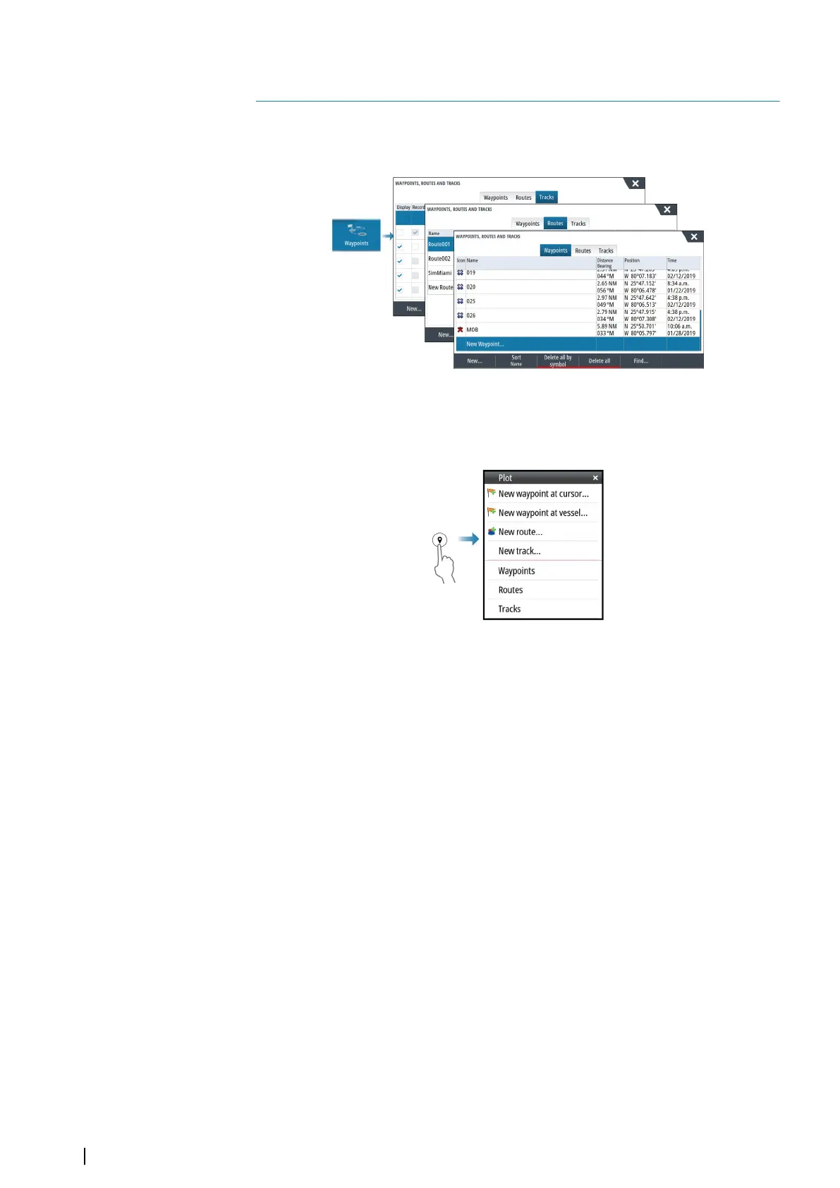
Waypoints, Routes, and Tracks dialogs
These dialogs give access to advanced edit functions and settings for these items.
The Plot dialog
Press and hold the mark/waypoint key to open the Plot dialog. Select an option to add new
or manage existing waypoints, routes or tracks.
Waypoints
About waypoints
A waypoint is a user generated mark positioned on the:
• chart
• echosounder image
• radar image
• navigation panel
Each waypoint has an exact position with latitude and longitude coordinates.
A waypoint positioned on the echosounder image has a depth value, in addition to position
information.
A waypoint is used to mark a position you later may want to return to. Two or more
waypoints can also be combined to create a route.
Saving waypoints
Save a waypoint at the cursor position if active or at the vessel's position if the cursor is not
active.
To save a waypoint:
• Press the rotary knob
• Press the Mark key
• Select the new waypoint option in the menu
5
40
Waypoints, routes, and tracks | NSS evo3S Operator Manual