Navigating
About navigating
The navigation function included in the system allows you to navigate to the cursor position,
to a waypoint, or along a predefined route.
If autopilot functionality is included in your system, the autopilot can be set to automatically
navigate the vessel.
For information about positioning waypoints and creating routes, refer to "Waypoints, routes, and
tracks" on page 40.
Navigation panels
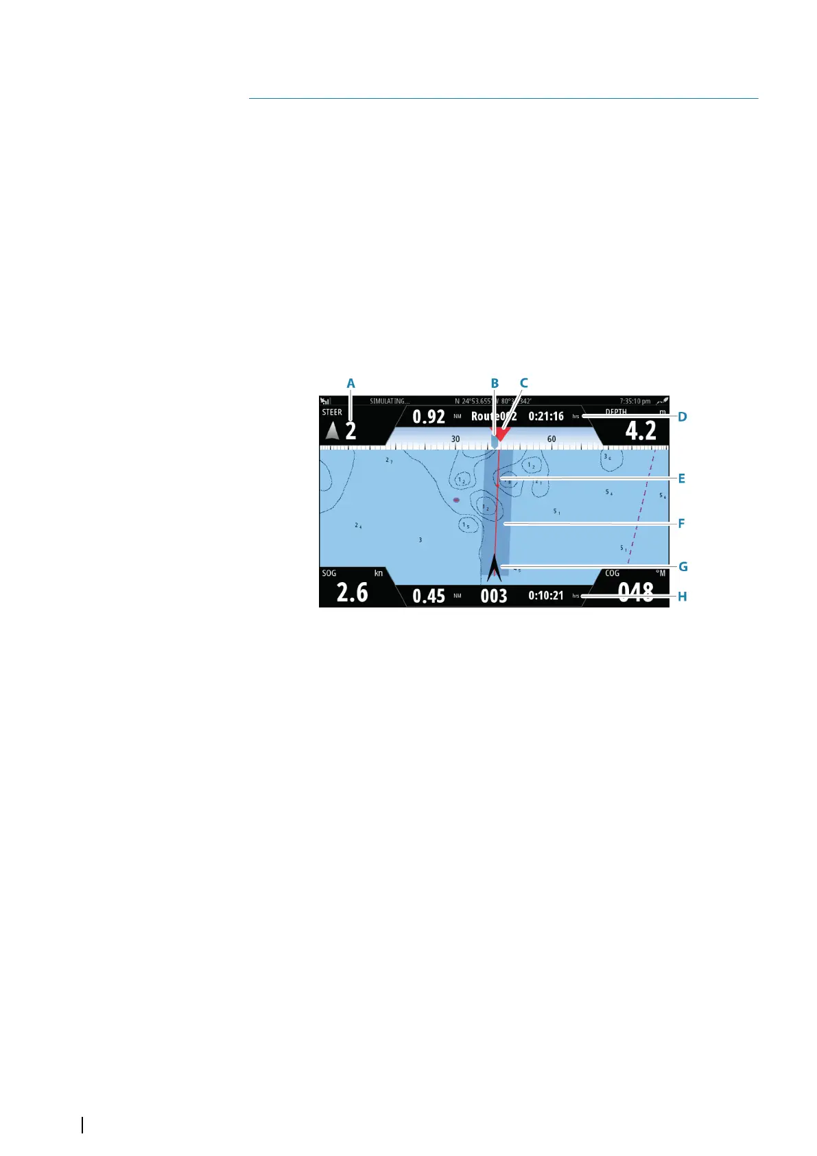
The Nav panel
The Nav panel is activated from the Home page, either as a full page panel or as part of a split
page.
A Data fields
B Vessel heading
C Bearing to next routepoint
D Route information
Indicates the distance of the route, the route name, and the estimated time to
reach the end of the route.
E Bearing line with allowed off course limit
When travelling on a route, the bearing line shows the intended course from one
waypoint towards the next. When navigating towards a waypoint (cursor position,
MOB or an entered lat/lon position), the bearing line shows the intended course
from the point at which navigation was started towards the waypoint.
F XTE limit
If the XTE (Cross Track Error) exceeds the defined XTE limit, this is indicated with a
red arrow including the distance from the track line. Refer to "XTE limit" on page 48.
G Vessel symbol
Indicates boat position and heading.
H Routepoint information
Indicates the distance to the routepoint, the routepoint name, and the estimated
time to reach the routepoint.
The Position panels
You can switch between displaying the Navigation panel or the Position panel. The Position
panel is activated from the menu.
By default, there is one position panel available showing GPS position.
6
46
Navigating | NSS evo3S Operator Manual