Waypoints, routes, and tracks
Waypoints, Routes, and Tracks dialogs
These dialogs give access to advanced edit functions and settings for these items.
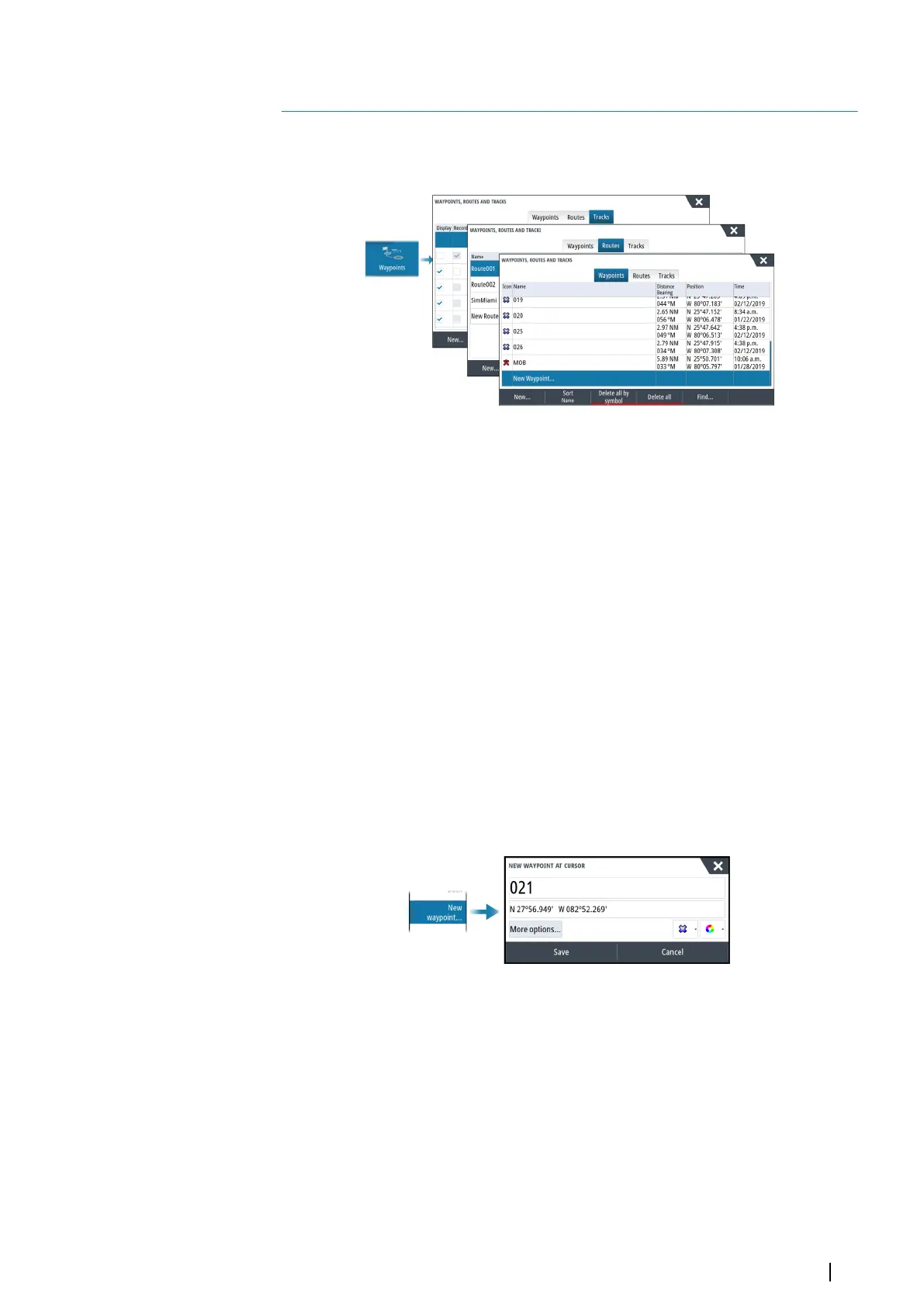
Waypoints
About waypoints
A waypoint is a user generated mark positioned on the:
• chart
• echosounder image
• radar image
• navigation panel
Each waypoint has an exact position with latitude and longitude coordinates.
A waypoint positioned on the echosounder image has a depth value, in addition to position
information.
A waypoint is used to mark a position you later may want to return to. Two or more
waypoints can also be combined to create a route.
Saving waypoints
Save a waypoint at the cursor position if active or at the vessel's position if the cursor is not
active.
To save a waypoint:
• Select the new waypoint option in the menu
Moving a waypoint
A waypoint can be moved from the position if active and if the waypoint is selected in the
menu.
To move a waypoint to a new position, select the move waypoint menu option and then
select the new waypoint location on the image.
To save the waypoint at the new position, select the finish moving menu option
Edit a waypoint
You can edit all information about a waypoint from the edit waypoint dialog.
The dialog is activated by selecting the waypoint, and then selecting edit from the menu.
The dialog can also be accessed from the waypoints tool on the home page.
5
Waypoints, routes, and tracks | NSO evo3S MPU Operator Manual
37