18 |
Charts | NSS Operator Manual
Categories
Insight charts includes several categories and sub-categories that you can turn on/off
individually depending on which information you want to see on your display.
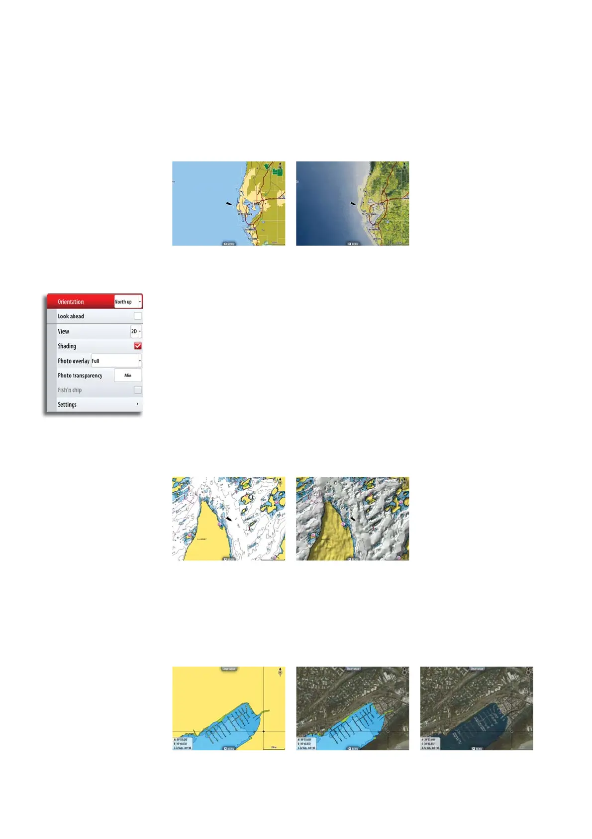
Chart imagery style
The charts can be displayed in two diff erent imagery styles, either as 2D basic mapping style,
or with shaded relief presenting chart including terrain imaging.
2D Shaded relief
Navionics chart options
Chart orientation and Look ahead
See page 16.
Chart view
The built in Navionics chart database provides you with detailed coastal cartography, with 2D
and 3D view options.
• 2D presents chart information in a basic mapping mode with Navionics details
• 3D provides a three dimensional graphical view of land and sea contours
Chart shading
Shading adds terrain information to the chart.
Traditional 2D chart Chart with shading
Photo overlay
Photo overlay enables you to view satellite photo images of an area as an overlay on the
chart. The availability of such photos is limited to certain regions.
You can view photo overlays in either 2D or 3D modes.
No Photo overlay Photo overlay, land only Full Photo overlay