Do you have a question about the Topcon GM-55 and is the answer not in the manual?
Fine adjustments to tripod legs for leveling the unit.
Using thumb screws to center the level bubble.
Rotating unit to center over tripod legs for stable leveling.
Making fine adjustments to the digital level bubble and pressing OK.
Rotating the total station to aim towards magnetic North.
Using the "0Set" function to establish the zero-degree direction.
Navigating to the All Apps section from the Windows icon.
Locating and opening the MAGNET Field app from its folder.
Editing optical configuration, entering name, type, manufacturer, and model.
Setting initial TS connection to Bluetooth TS.
Setting measurement method and tolerances for survey.
Setting measurement type, target type, and EDM mode.
Configuring distance, area, and volume units to US Feet.
Configuring measurement and calculation angle units and precision.
Configuring coordinate units, precision, and height precision.
Configuring temperature and pressure units.
Setting coordinate type, plane order, geodetic azimuth, direction, and station prefix.
Connecting the FC-5000 to the GM-55 via Bluetooth, including PIN settings.
Creating a new survey job with specified name, creator, and comments.
Adding the first occupation point with coordinates and code.
Setting the benchmark elevation, including instrument height and measurement.
Performing a backsight on the benchmark point to establish data.
Taking survey shots using the Survey and Topo functions.
Viewing and adjusting map properties for survey data points.
Selecting data, format, file path, name, delimiter, and file style for export.
Configuring precision for plane coordinates and elevation during export.
Closing the MAGNET Field application.
Shutting down both data collector and total station and packing equipment.
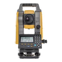
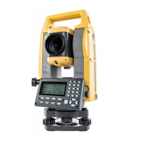
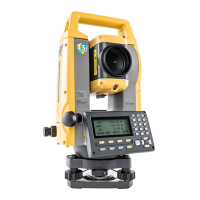
This document outlines the setup, operation, and maintenance procedures for the Topcon GM-55 Total Station when used with a Topcon FC-5000 Data Collector, specifically for Maryland NRCS applications.
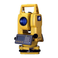
The Topcon GM-55 Total Station is a surveying instrument designed for precise angle and distance measurements, crucial for various land surveying and construction tasks. It integrates with the Topcon FC-5000 Data Collector, which runs MAGNET Field® software, to streamline data collection and management.
The primary function of the Topcon GM-55 Total Station, in conjunction with the FC-5000 Data Collector, is to accurately measure points in a survey area. This involves establishing a benchmark elevation, performing backsight measurements, and collecting general survey data points (sideshots). The system allows for the creation of new survey jobs, definition of instrument and target parameters, and configuration of measurement units and display settings. Data collected can be viewed on a map and exported into various file formats for further processing.
<user-defined>).<user-defined height of instrument><user-defined rod/prism height><user-defined height of instrument><user-defined rod/prism height><user-defined; pick from drop-down list><user-defined file name>This comprehensive guide ensures proper handling, configuration, and operation of the Topcon GM-55 Total Station with the FC-5000 Data Collector for accurate surveying tasks.
| Brand | Topcon |
|---|---|
| Model | GM-55 |
| Category | Measuring Instruments |
| Language | English |