Do you have a question about the Topcon Synergy GM-50 series and is the answer not in the manual?
| Brand | Topcon |
|---|---|
| Model | Synergy GM-50 series |
| Category | Measuring Instruments |
| Language | English |
Cautions related to tripod setup and handling.
Warnings regarding Bluetooth usage near medical equipment and aircraft.
Guidelines for charging the battery within the specified temperature range.
Details on IP66 specifications and maintaining water/dust resistance.
Warnings regarding hazardous radiation exposure and safety instructions.
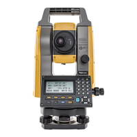
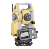
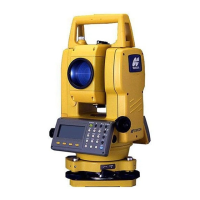
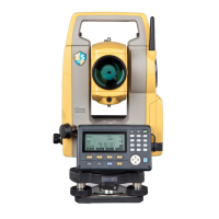
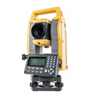
Identifies and labels the parts of the instrument.
Identifies and explains the function of each key on the instrument.
Details the functions assigned to the soft keys in different modes.
Step-by-step guide to powering on the instrument.
Explains how to interpret the battery power indicator.
Explains automatic tilt correction for precise angle measurements.
Guide for inputting text and numbers using the instrument's keys.
Detailed procedure for levelling the instrument using circular and electric levels.
Procedures for focusing the telescope and sighting targets accurately.
Procedure for centering the instrument over the survey point using optical plummet.
Step-by-step guide for centering with the optional laser plummet.
Basic procedure for measuring horizontal and vertical angles.
How to select the target type for distance measurement.
How to set atmospheric correction values for accurate measurements.
Procedure for stake out operations using measured distances.
How to set the instrument's occupied point coordinates.
How to input the instrument height for coordinate measurements.
Step-by-step process for measuring coordinates.
How to input the prism height for coordinate measurements.
How to set Occupied and Backsight points.
How to adjust systematic errors in instrument measurements.
General preparation steps for data collection.
How to select a coordinate file for occupied/backsight points.
How to set occupied and backsight points for data collection.
Step-by-step guide for the data collection process.
How to set various parameters for data collection.
How to select a file for storing data.
How to select a coordinate data file for layout.
How to set the occupied point for layout using coordinate data.
How to set the backsight point using coordinate data.
Steps for executing a layout operation.
Explains how atmospheric conditions affect light velocity and correction formulas.
How to manually input temperature, pressure, and humidity values.
Instructions for charging the instrument's battery.
Procedures for installing and removing the battery.
Steps for inserting a USB flash drive for data transfer.
Steps for safely removing a USB flash drive.
Checking and adjusting the instrument's circular level.
Procedure for adjusting the vertical angle 0 datum.
Procedure for adjusting systematic errors in instrument measurements.
Checking and adjusting the optical plummet.
How to check and maintain the additive distance constant.
How to check and adjust the laser plummet.
How to select an existing job.
Operations for setting up and starting work.
Direct input of occupied point coordinates.
Directly entering backsight information.
Procedures for setting backsight.
Procedure for executing a layout operation.
Steps for conducting ordinary measurements and recording coordinates.
Procedure for deleting coordinate data.
How to delete job files.
How to set occupied and backsight points.
Setting occupied point using existing coordinate data.
How to add coordinate data.