Do you have a question about the VDO MAP 7wi Plus GPS and is the answer not in the manual?
Introduction to the manual's purpose, scope, and basic operation of the chart plotter.
Explanation of key conventions, symbols, and terminology used throughout the manual.
Overview of advanced functions that may need activation for extended capabilities.
Description of the manual's structure, detailing chapter organization.
Information on how to obtain support and assistance if problems arise.
Critical warnings regarding chart accuracy, official charts, and safe navigation.
Essential cautions for safe operation, handling, and environmental exposure.
Detailed procedure for safely cleaning the plotter screen surface.
Introduction to the chart plotter's main features, keys, and functions.
Details on C-MAP MAX cartography data features and benefits.
Explanation of the GPS system, how it works, and position fixing accuracy.
Instructions for powering the chart plotter on and off correctly.
How to adjust screen backlight and contrast levels for optimal visibility.
Guide to selecting the preferred user interface language for menus.
How to set the language for chart information display and object translation.
Instructions for inserting, removing, and using C-MAP data C-CARDs.
How to use the built-in simulator for practice and proficiency.
How to control the chart display, change modes, and adjust the chart scale.
Procedure for setting and navigating to a single destination point.
Explanation of the Electronic Bearing Line (EBL) and Variable Range Marker (VRM) function.
Procedure for activating the Man Overboard (MOB) function for safety.
Managing user points like marks and waypoints on the chart.
Creating, editing, and following navigation routes.
Function for navigating directly to a destination point on the map.
How to use the track logging feature to record vessel movement.
Accessing information on cartographic objects displayed on the chart.
Obtaining detailed port services and tide prediction information.
Using the find function to locate ports, services, and points of interest.
Setting and managing various audible and visual alarms for safety.
Backing up and restoring data using the User C-CARD.
Configuring map display settings like zoom type, fonts, and orientation.
Customizing other map display settings, including marine and land features.
Setting general system configurations like language and units.
Accessing and configuring advanced system settings and menus.
Setting up and using the Automatic Identification System (AIS).
Accessing system information, software details, and background charts.
Configuring input and output devices, ports, and communication settings.
Utilizing the C-Weather Service for accessing and displaying weather forecasts.
Information on the Fish Finder's sonar performance and capabilities.
Information on the Radar's scanner unit and display capabilities.
Understanding the C-LINK system for sharing cartographic data between plotters.
Transferring navigation data (routes, destinations) between linked chart plotters.
Setting up software for MOBILARM communication via NMEA input.
Checking the status of the connected MOBILARM system and its components.
Information about MOBILARM PTX personal transponder devices.
Procedures for placing the cursor on PTX icons and managing them.
Procedure to switch on the internal Fish Finder and its basic settings.
Understanding the elements and display of the Fish Finder page.
How to display and customize different Fish Finder pages (Full, Zoom, Chart/Fish).
Explanation of the different zoom modes for the Fish Finder display.
Accessing the Fish Finder setup menu for configuration options.
Using preset modes for quick Fish Finder setup and operation.
Selecting gain and range modes for optimal Fish Finder performance.
Setting depth and shift parameters in manual range mode.
Setting bottom range and operating frequency for the Fish Finder.
Using interference rejection and configuring sensitivity settings.
Customizing the Fish Finder display settings like colors and scrolling.
Setting transducer parameters and configuring sonar alarms.
Loading and saving Fish Finder settings to/from a User C-CARD.
Information about transducers used with the Fish Finder system.
Performing system tests for troubleshooting and problem diagnosis.
Managing serial port parameters for external device communication.
Testing modem connections and the external alarm functionality.
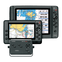
Key features and functions of the MAP 7w and MAP 7wi Plus GPS models.
Detailed technical specifications for the chart plotter models.
Procedures for inserting and removing C-CARDs into the chart plotter.
Physical dimensions of the chart plotter unit.
Instructions for installing and removing the chart plotter unit.
Wiring diagrams for connecting external devices to the chart plotter.
Diagrams illustrating typical connections of peripherals to the chart plotter.
Key features and functions of the MAP 7cwi Plus GPS chart plotter.
Detailed technical specifications for the chart plotter unit.
Technical specifications for the integrated Fish Finder module.
Procedures for inserting and removing C-CARDs into the chart plotter.
Physical dimensions of the chart plotter unit.
Instructions for installing and removing the chart plotter unit.
Wiring diagrams for connecting external devices to the chart plotter.
Diagrams illustrating typical connections of peripherals to the chart plotter.
Key features and functions of the MAP 11csE Plus GPS chart plotter.
Detailed technical specifications for the chart plotter unit.
Procedures for inserting and removing C-CARDs into the chart plotter.
Physical dimensions of the chart plotter unit.
Instructions for installing and removing the chart plotter unit.
Wiring diagrams for connecting external devices to the chart plotter.
Diagrams illustrating typical connections of peripherals to the chart plotter.
Key features and functions of the MAP cx Plus GPS controller.
Detailed technical specifications for the controller unit.
Procedures for inserting and removing C-CARDs into the controller.
Physical dimensions of the controller unit.
Instructions for installing and removing the controller unit.
Wiring diagrams for connecting external devices to the controller.
Diagrams illustrating typical connections of peripherals to the controller.
Details on CAN interfaces and SAE J1939 data for the MAP 11csE Plus GPS.
Step-by-step guide for selecting a location and installing the GPS antenna.
Physical dimensions and mounting details of the GPS antenna.
| Resolution | 800 x 480 pixels |
|---|---|
| Touchscreen | Yes |
| GPS | Yes |
| Screen Size | 7 inches |
| Power Supply | 12/24V DC |
| Weight | 800g |