35
User Manual
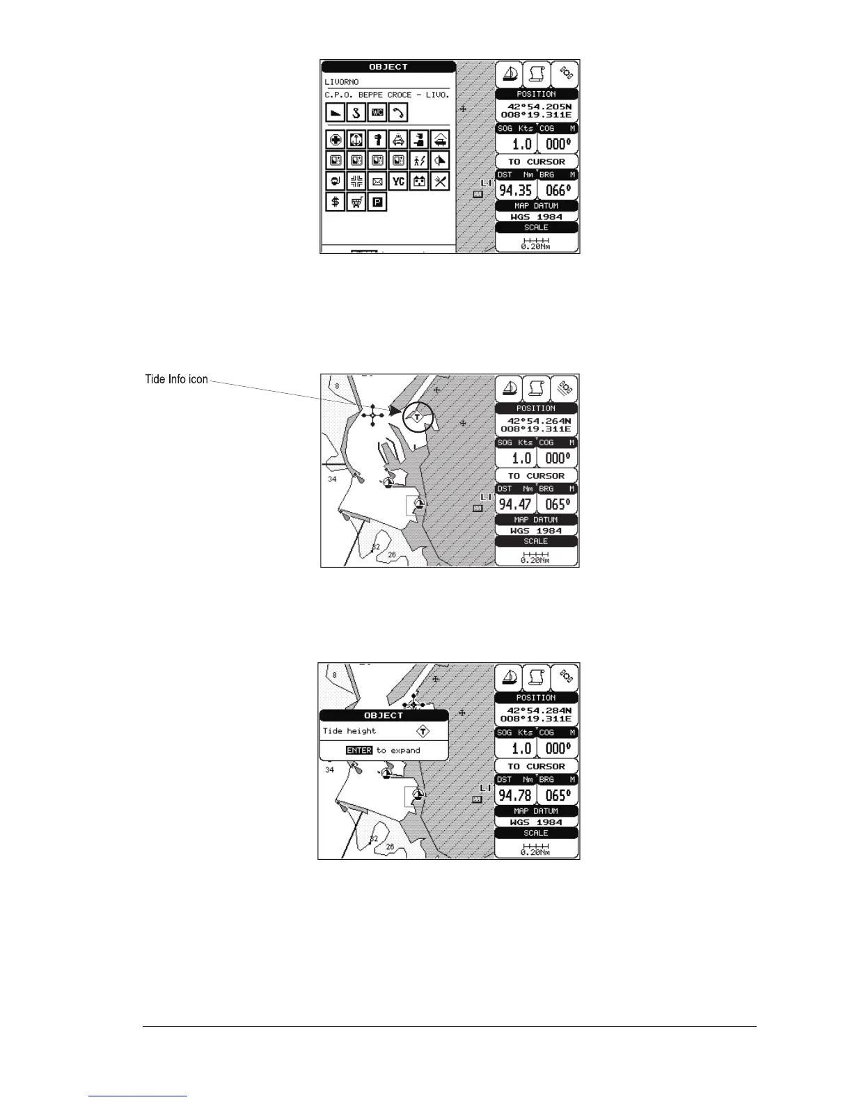
Fig.3.6a - Automatic Info window on Port
To expand information about that object press [ENTER].
NOTE Port Info icon is visible only if the Ports + Services option is On
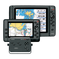
Getting Tide Info
Fig. 3.6b - Tide Info icon
By placing the cursor over the Tide Station icon, the chart plotter pops-up the
relative automatic info window (see picture below) and allows displaying a graphical
page with the tides prediction of the selected object.
Fig. 3.6c - Automatic Info window on Tide
Use [ENTER] to display the Tide Graph page. It shows the Tide height variations
during the 24 hours at any given day.