PLG12863E AFI4700 Pilot’s Guide 64
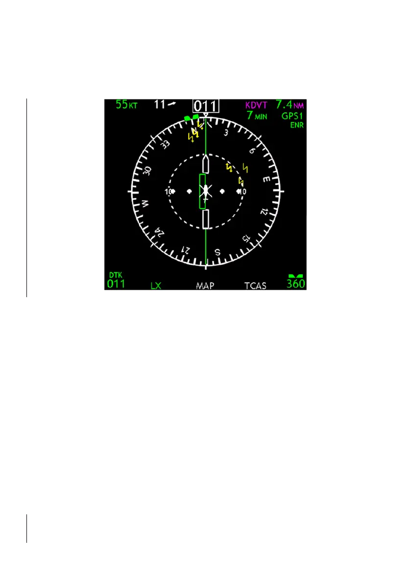
When the FMS/GPS primary navigation source is selected and the
CDI overlay is selected, the CDI will be displayed in place of the map.
Figure 3-20: GPS CDI
Ground Speed
GPS derived ground speed is displayed in knots.
Wind Vector
Wind direction and magnitude are displayed relative to the aircraft’s
orientation.
Ground Track
This white caret displays the track of the aircraft over the ground. This
is useful when correcting for wind.
Active Waypoint
The active waypoint is displayed in magenta alphanumeric symbols.
Time to Waypoint
Time to the active waypoint is displayed in MM (minutes).


 To Next Page