58
Button Main function (single tap) Function (tap and hold)
Switches between the daytime and night color
schemes manually. This will not disable the
automatic switching between the two schemes: the
other color scheme returns later.
Opens Color Profiles settings.
3D buildings can be displayed on the map. Use this
switch to suppress them temporarily.
Opens 3D Settings.
Tap this button and select the Vehicle type to be
used for route calculation. Otherwise it is selected
in Route Planning options in Settings (page 68).
Changing the Vehicle type triggers an automatic
route recalculation.
Opens Route Planning
options.
Turns track log recording on or off otherwise
controlled on the Manage Track Logs screen.
Opens Manage Track Logs.
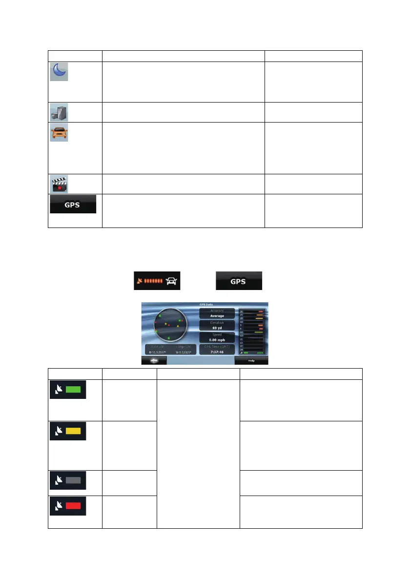
Opens the GPS Data screen with satellite
information, data coming from the GPS receiver,
and a shortcut to the GPS Settings screen if
needed (GPS receiver detection is automatic).
n/a
4.1.9 GPS Data screen
Tap the following buttons: , and then to open the GPS Data screen
and to see the status of GPS reception.
Icon Color Name Description
Green GPS position quality
indicator
Clarion Mobile Map has a connection
to the GPS receiver and GPS position
information is available in 3D: Clarion
Mobile Map can calculate both your
horizontal and vertical GPS position.
Yellow Clarion Mobile Map has a connection
to the GPS receiver and GPS position
information is available in 2D: only the
horizontal position is calculated,
Clarion Mobile Map cannot calculate
your vertical GPS position.
Gray Clarion Mobile Map has a connection
to the GPS receiver but GPS position
information is not available.
Red
Clarion Mobile Map has no connection
to the GPS receiver.
Since the device has a built-in GPS
 Loading...