59
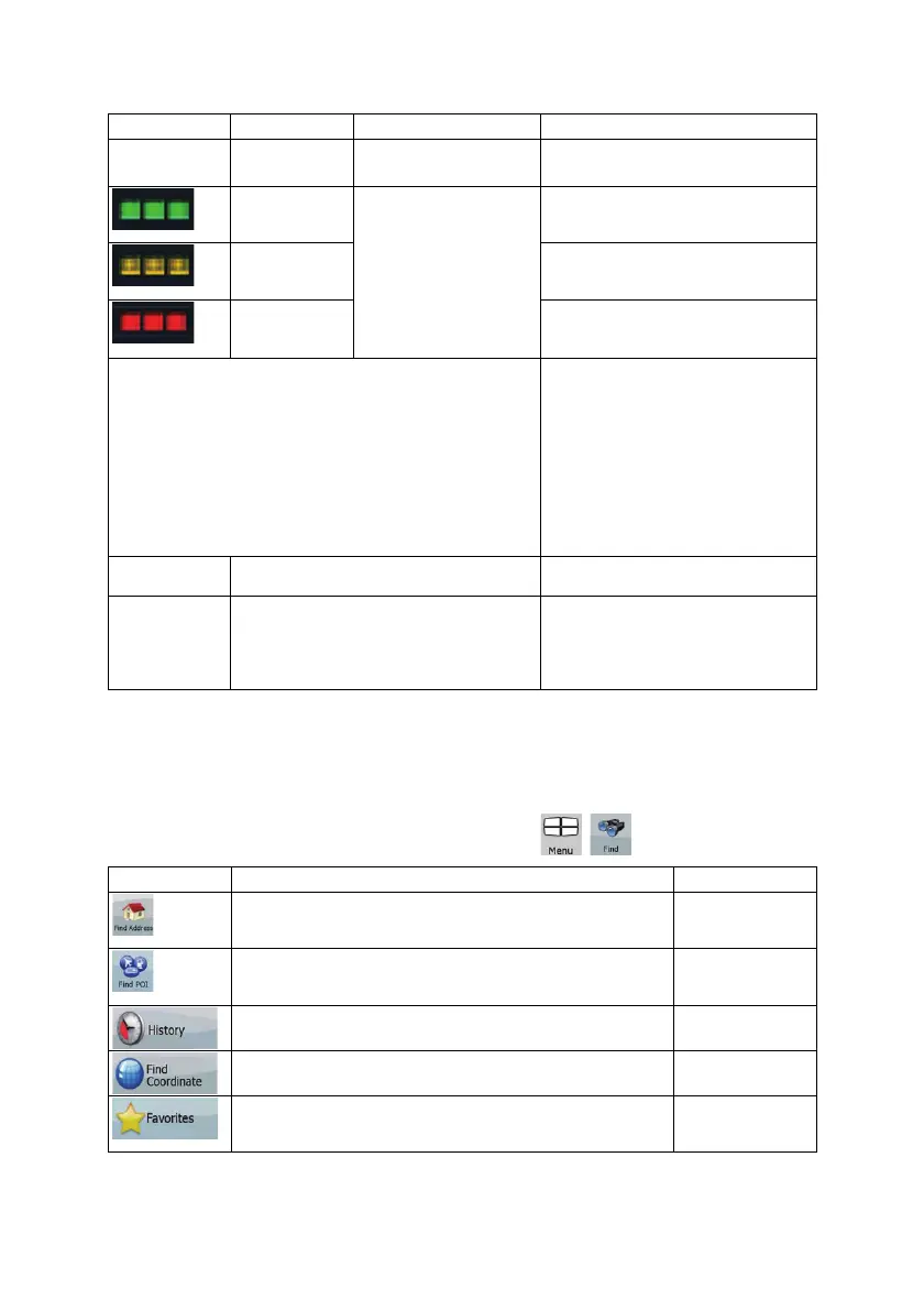
Icon Color Name Description
receiver, this status should not appear
under normal circumstances.
Green, blinking GPS connection quality
indicator
Clarion Mobile Map is connected to
the GPS receiver.
Yellow, blinking Clarion Mobile Map has no connection
to the GPS receiver but it is still trying
to establish a connection.
Red, blinking Clarion Mobile Map has no connection
to the GPS receiver and is not trying to
establish a connection.
Sky view circle
The virtual sky shows the visible part
of the sky above you, with your
position as the center. The satellites
are shown at their current positions.
The GPS receives data from both the
green and yellow satellites. Signals
from the yellow satellites are only
received, while green ones are used
by the GPS receiver to calculate your
current location.
n/a
Coordinates Your current GPS position in WGS84
format.
n/a
Status bar for the satellites Dark bars are for the yellow and lit
bars are for the green satellites. The
more satellites your GPS tracks (the
green ones), the better is your
calculated position.
4.2 Find menu
Select the destination of your route. Tap the following buttons: , .
Button Description Reference
If you know at least a part of the address, this is the quickest
way to find the location.
page 29
You can select your destination from the thousands of POIs
included with Clarion Mobile Map or from the ones you have
previously created.
page 36
The destinations that you have already entered in Clarion
Mobile Map are available in the History list.
page 38
You can select your destination by entering its coordinates. page 38
You can select as your destination a location that you have
already saved as a Favorite.
page 36