21
Figure: IMU Calibration enabled
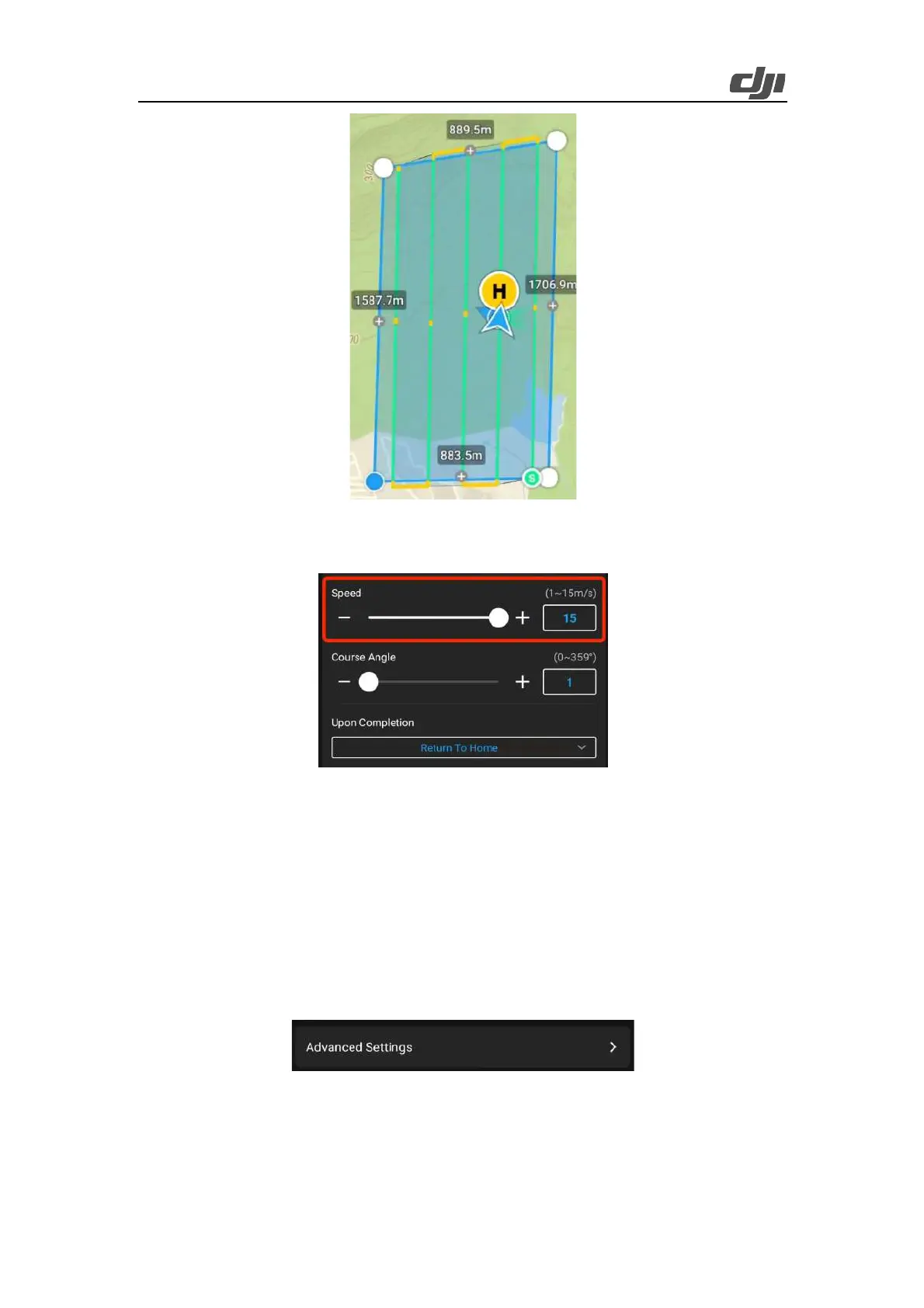
11) We recommend that you set the flight speed to 15 m/s. (The lower the flight speed, the higher
the point cloud density.)
Figure: Flight speed at 15 m/s
12) You can set Course An g le to adjus t t h e ro u te dir e ct ion. By defau l t, the ro u te is paral l el to the
long side of the mapping area.
13) We recommend that you set Upon Completion to Return To Home.
14) In Advanced Settings, set Side Overlap (LiDAR) and Forward Overlap (Visible).
15) The default value of Side Overlap (LiDAR) is 20%. If you need a higher point cloud density
or the mapping area has large, steep terrain undulations, you can adjust the value to 50%.
16) If you need to obtain both LiDAR point cloud data and digital orthophoto map data, we
recommend that you set Forward Overlap (Visible) to 70%. Note that adjusting the value of
Forward Overlap (Visible) will affect the highest flight speed.
 Loading...