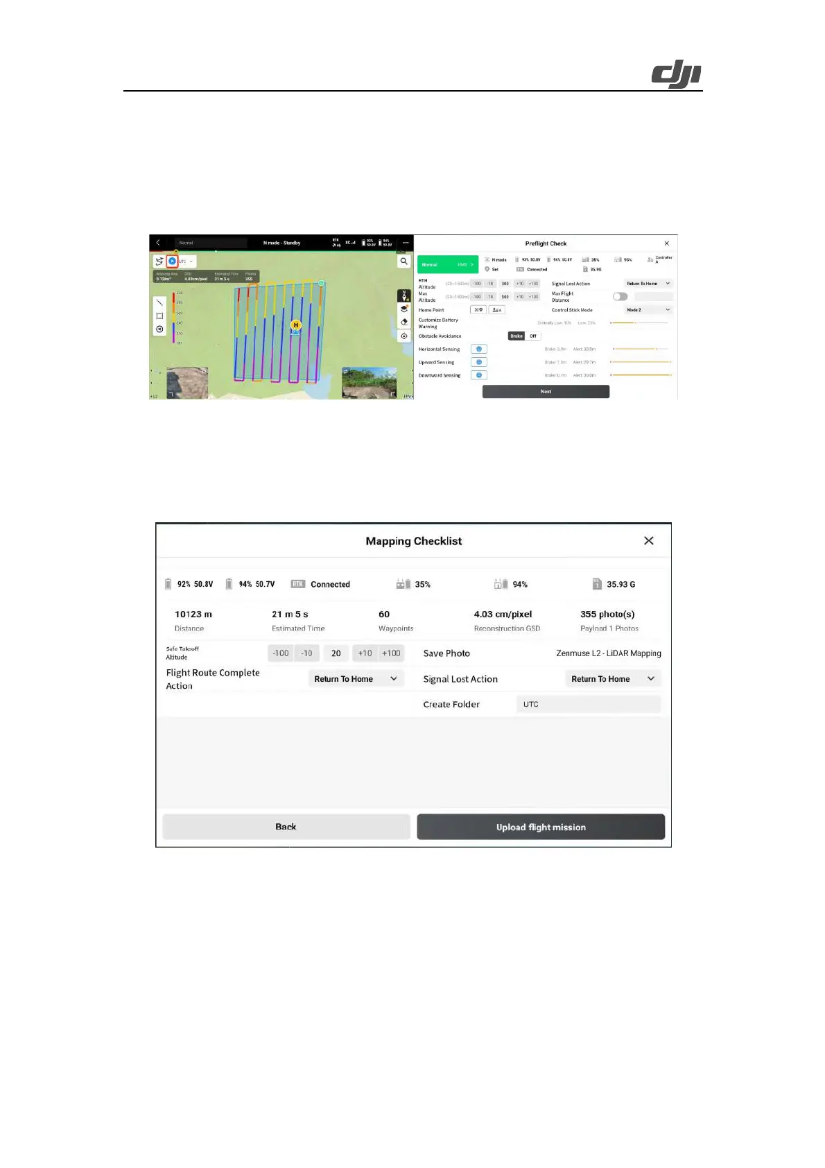
24
controller is in N mode, the devices have been sufficiently charged, the RTK status is normal (if
PPK technology is used, GNSS can be used), the microSD card has sufficient storage space, the
RTH altitude and max altitude are higher than the route altitude, the signal lost action is Return To
Home, the Max Flight Distance switch is turned off, and the control stick mode is Mode 2. If the
mapping area has strong winds or the batteries cycles are high, we recommend that you set the low
battery warning threshold to a higher value and set Obstacle Avoidance to Brake.
Figure: Pre-flight checklist
Tap Next to set the signal lost action, which is the action performed by the aircraft after signal loss
during a route-based flight. You can select Continue or Return To Home, in most cases that return
to home settings is recommended. After the check, ensure that the flight site is unobstructed and
safe, and then upload the flight task for execution.
Figure: Route check
3.1.2.3.2. Route-based Operations
Enter the camera view. You can use the side buttons to switch between the LiDAR view and the
visible light view. During the flight, keep an eye on the status of RTK and IMU calibration. You can
tap the laser ranging icon to view the real-time altitude relative to the ground.
 Loading...