46
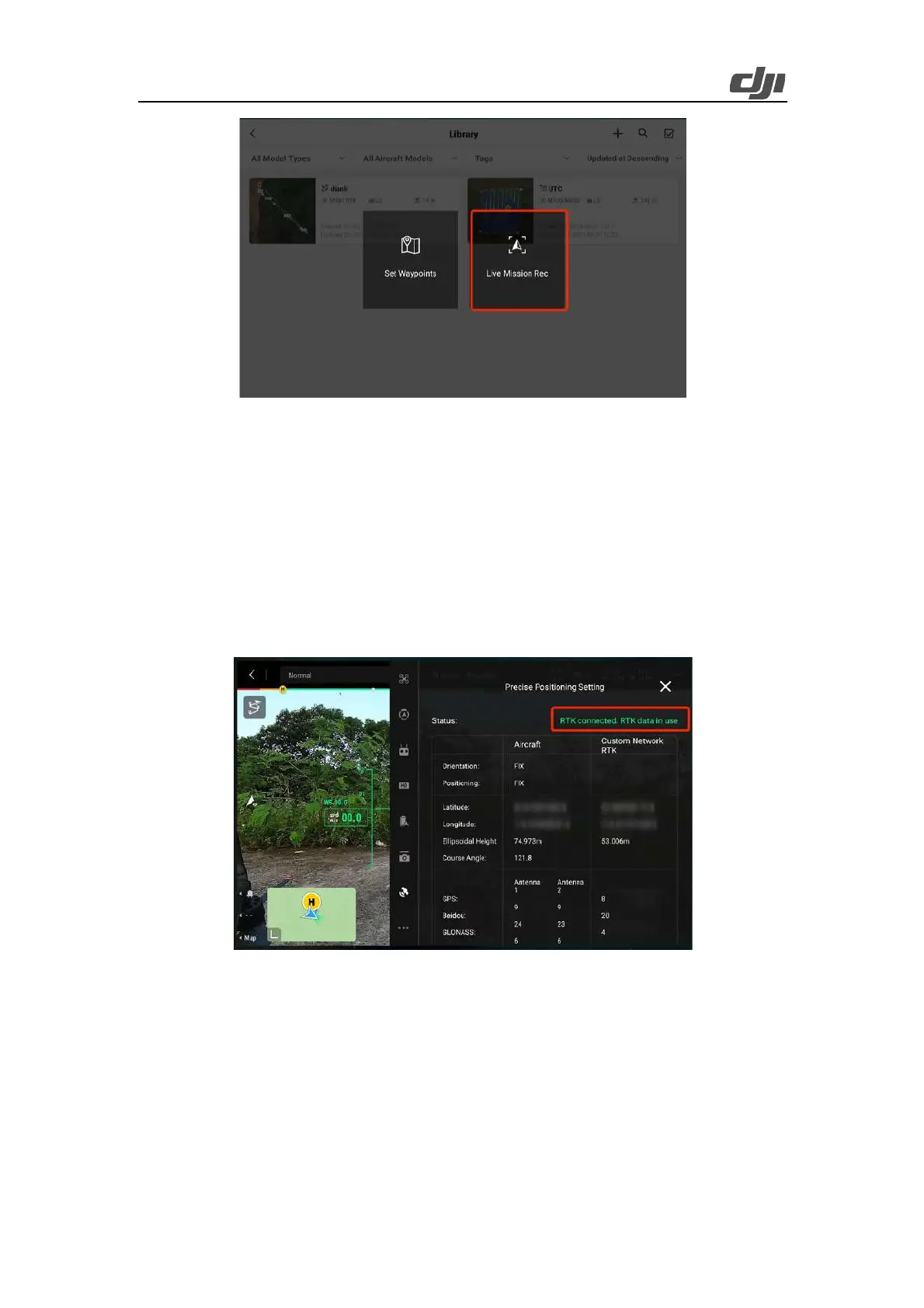
Figure Live task recording
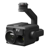
Enable the network RTK feature and select an appropriate coordinate system. (DJI Terra supports
reconstruction of LiDAR point cloud data collected by using the WGS84 geodetic coordinate
system.) Before takeoff, make sure the RTK status of the aircraft is FIX and you hear a voice prompt
reading "RTK connection successful. The absolute altitude of the aircraft will be recorded" if the
controller's sound is on.
Special circumstance: If the mapping area has no network signal but coordinates are known, you
can set up the D-RTK 2 Mobile Station in a position with known coordinates to achieve high-
precision positioning or switch Zenmuse L2 to the GNSS flight mode for point cloud data collection
and reconstruction.
Figure: RTK connection status
Top waypoints: Tap the record button to add a waypoint and snap a photo when the aircraft is over
the top of the tower at a proper altitude. To ensure the integrity of the tower on the map, you are
recommended to set the waypoint at an altitude twice the tower height, usually 20-30 meters (65 to
100 feet). You can adjust the aircraft's downward obstacle avoidance range to 30 meters and confirm
the aircraft's distance from the tower top with the help of the obstacle avoidance alerts.