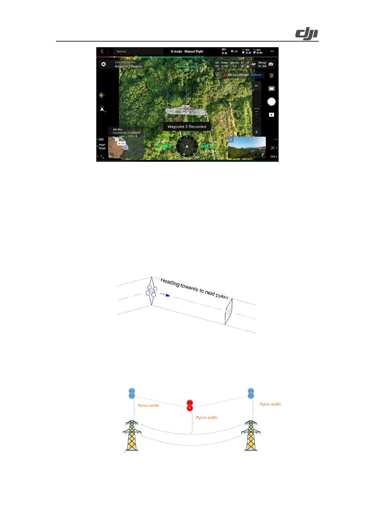
47
Figure: Record a waypoint
If the distance between the current waypoint and the next waypoint is longer than 10 m, the aircraft
adjusts the yaw angle at the current waypoint to align with the route before heading for the next
waypoint. To improve flight efficiency, we recommend that you always orient the aircraft towards
the next base power during waypoint setup to create an optimal route.
For reference: For common power transmission lines, it is discovered about the RGB mapping
camera of Zenmuse L2 that when the gimbal yaw recenters, the gimbal pitch is -90°, and the two
auxiliary vertical lines overlap the guiding lines on the upper left and upper right, high-quality point
cloud data can be collected at the route altitude.
Sag waypoints accounting for line sag: For steps with a larger sag (for example, when the drop
exceeds 50 meters), we recommend that you add a waypoint at a proper altitude (such as 30 meters)
over the top of the largest sag point to ensure better reconstruction quality for this step.
Figure: Top and sag waypoints of tower
Fore and aft waypoints: Add an auxiliary waypoint at a proper altitude over the lines around 50