Do you have a question about the Garmin GPSMAP 292 and is the answer not in the manual?
Details the manual's organization into sections for user guidance.
Provides crucial safety warnings and essential operational data.
Steps for turning the unit on/off and initial setup.
Using simulator mode for practice and adjusting screen brightness.
Explains the function of each key and the map pointer.
How to enter data, select options, and manage waypoints.
Guides on navigating to destinations, routes, and track logs.
How to search for waypoints, map items, and chart data.
Covers Digital Selective Calling and AIS features for communication.
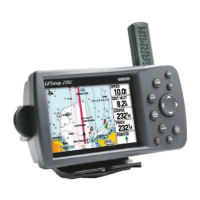
Details the electronic cartography and navigational data display.
Provides graphic steering guidance to a destination.
Offers 3-D graphic steering guidance on a virtual highway.
Shows route points, distance, ETA, and fuel information.
Visual reference of satellite acquisition and receiver status.
View tide and current information with graphical charts.
Shows trip odometer, average speed, and time data.
Shows sun/moon rise/set, moon phase, and sky view data.
Manages waypoints and proximity alarms for alerts.
Creating, copying, deleting, and navigating routes.
Specifies recording, defining, and saving track log data.
Handles DSC features and data card transfers.
Shows messages generated by the GPSMAP 292/298.
Customizes main pages, map display properties, and sonar settings.
Configures system, units of measure, and alarm settings.
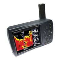
Functions as a fishfinder/flasher with detailed sonar data.
Options for customizing sonar tab settings like water type and gain.
Explains sonar wave transmission, reception, and display.
Explains how to interpret signals on the Flasher Page.
Displays map and sonar data simultaneously.
Details physical, performance, power, and sonar specifications.
Guides for installing antenna, mounting, transducer, and cable.
Covers external device interfacing and screen maintenance.
Instructions for installing and removing data cards.
Details satellite status, WAAS/EGNOS, and location accuracy.
Explains Maritime Mobile Service Identity (MMSI) for VHF radio.
Glossary of terms used in navigation and on the unit.
Lists and explains various system messages and alarms.
Lists optional accessories to enhance unit operation.
Covers software license, product registration, warranty, and compliance.
| Display Resolution | 320 x 240 pixels |
|---|---|
| Receiver | 12 parallel channel GPS receiver |
| Basemap | Yes |
| Waypoints/favorites/locations | 3000 |
| Routes | 50 |
| Waterproof rating | IPX7 |
| Battery life | Up to 15 hours |
| Weight | 1.5 lbs (680 g) |
| Bluetooth | No |
| Wi-Fi | No |
| Display Type | QVGA |
| Preloaded maps | Americas |
| Track log | 10, 000 points, 15 saved tracks |