Do you have a question about the Garmin GPSMAP 5215 and is the answer not in the manual?
Quick methods to navigate and access features on the chartplotter.
Explains symbols, actions, and indicators used in the manual for clarity.
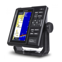
Identifies physical buttons, ports, and indicators on the chartplotter.
Guides through powering on, initial settings, GPS acquisition, and display adjustments.
Instructions for inserting and removing data and memory cards.
Accessing system information and understanding the Home screen layout.
How to use the Navigation Chart, including symbols, panning, and zoom.
Adjusting symbols, tracks, navaids, icons, and map orientation for display.
Explores 3D views like Perspective and Fish Eye, plus the Fishing Chart.
Satellite imagery, aerial photos, tide/currents, POIs, and Auto Guidance.
Understanding AIS information and how to target vessels using symbols.
Managing AIS targets, collision alarms, and activating/deactivating tracking.
Information on AIS-SART transmitters and their use in rescue scenarios.
Selecting, arranging, and customizing combination screens and data fields.
Adding, editing data fields, and viewing engine/fuel gauges.
How to display a selected combination screen in full-screen mode.
FAQ on bearing, course plotting, and general navigation questions.
Choosing destinations and setting courses using Go To, Route To, or Guide To.
Creating, saving, editing, and managing waypoints and routes.
Recording, saving, showing, and retracing boat tracks.
Connecting and engaging the Garmin autopilot for automated navigation.
Finding and navigating to marine services and searching destinations by name.
Browsing and following saved routes or recorded tracks for navigation.
Viewing tide, current, and celestial information.
Displaying and configuring graphs for wind, temperature, pressure, and depth.
Engine/fuel gauges, trip gauges, and video input management.
Adjusting map detail, language, sound, and using simulator mode.
Configuring route labels, turn transitions, and speed data sources.
Setting auto guidance parameters and units of measure.
Configuring data bars, boat info, and alarms.
Copying data, backing up, and configuring NMEA/network connections.
Transmitting signals, using radar modes, and configuring guard zones.
Acquiring, tracking targets with MARPA, and viewing threat lists.
Superimposing radar data onto charts for enhanced situational awareness.
Adjusting gain, clutter, FTC, and other settings for optimal radar performance.
Configuring color schemes, orientation, and antenna settings.
Explains full-screen, split-zoom, and split-frequency sonar displays.
Adjusting zoom, gain, scroll speed, picture advance, and screen shifting.
Configuring transmit settings, frequencies, and transducer diagnostics.
Setting sonar alarms and configuring transducer offsets.
Chartplotter and VHF radio interaction for DSC features.
Viewing, adding, and editing DSC contacts and call reports.
Initiating and responding to distress and man-overboard calls.
Tracking vessels, making routine calls, and communicating with AIS targets.
Technical details including physical dimensions, power, and environmental ratings.
Calibration, screenshots, system info, NMEA setup, and device registration.