36
English
Tap the X button again (changed into a right arrow during
pause) to resume data logging in continuous mode.
If you come back to the main menu by tapping on MENU,
then data logging in continuous mode is automatically
stopped.
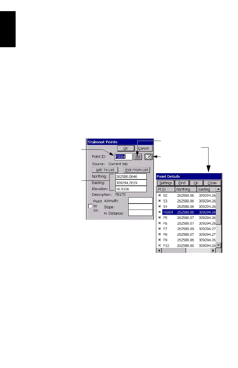
Staking out RTK Points
1. Tap on the Surv tab and then select Stakeout Points. The
screen now displayed allows you to stake out your points.
2. On this screen, FAST Survey asks you to choose the point
you want to stake out. You can either type in its coordi-
nates in the Northing, Easting and Elevation fields, or select
a pre-defined point from the points list (see File>List
Points). You can also, define graphically this point by tap-
ping on the point on the graphic screen, or define that
point according to azimuth, slope and horizontal distance.
Coordinates of point
to be staked out
Name of point to
be staked out
Provides access to
graphic screen
Provides access to points list.
Example of points list: