Do you have a question about the NorthStar EXPLORER 550 and is the answer not in the manual?
Explains DANGER, WARNING, and CAUTION symbols and user responsibility for hazard communication.
States user responsibility and outlines FCC compliance regarding radio frequency emissions.
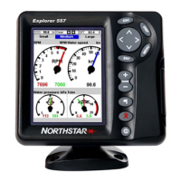
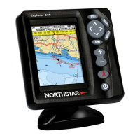
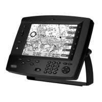
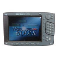
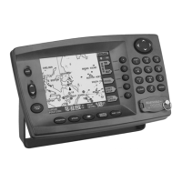
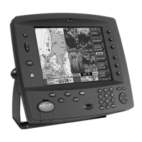
General description of the Northstar EXPLORER chartplotter, its features, and capabilities.
Instructions for cleaning the screen and unit to ensure optimal performance and longevity.
Explains the types of plug-in cards (C-MAP chart and user cards) and their functions.
Explains how to use the device's physical keys, including press, hold, and cursor actions.
Details how to navigate through menus, select submenus, commands, and change data values.
Instructions for manually powering the unit on/off and configuring auto power settings.
Explains the MOB feature, which saves the boat's position and navigates back to it.
Covers how the unit alerts users to alarm conditions and how to clear them.
Guides users on accessing and switching between different display modes like Chart, Highway, and Gauges.
Details how to configure the data header displayed at the top of chart and highway screens.
Describes how to display and manage the compass on chart and highway displays.
Introduces navigating to a point and following a route.
Details how the EXPLORER displays navigation data when navigating to a destination point.
Explains how to select and navigate to waypoints or specific points on the chart.
Guides on preparing, starting, navigating, skipping, and cancelling routes.
Explains 'Centre on boat' and 'Cursor mode' for different viewing preferences.
Details how latitude and longitude are displayed and the difference between boat and cursor positions.
Explains how to adjust the chart scale for zooming in or out to view different levels of detail.
Describes viewing information about chart symbols by moving the cursor over them.
Explains how to enable or disable the perspective view for charts.
Details using the calculator to plot courses, measure distances/bearings, and save as routes.
Describes recording, displaying, and managing boat tracks for navigation and retracing.
Explains the highway display's bird's eye view of the boat's course and its components.
Covers creating, editing, displaying, deleting, and sorting waypoints.
Details the information shown in the waypoints list, including name, position, and type.
Covers creating, editing, moving, and deleting waypoints.
Instructions on creating new waypoints from any display or the chart display.
Guides on editing waypoint data from either the chart display or the waypoints list.
Explains how to center the chart display on a selected waypoint.
Provides instructions for deleting all saved waypoints from the system.
Explains how to modify specific data fields of a waypoint.
Refers to section 3-1-2 for instructions on navigating to a waypoint.
Shows how to view a list of created routes, including name, start/end points, and distance.
Covers the creation, editing, and management of navigation routes.
Provides detailed steps for creating new routes from the chart display or the routes display.
Explains how to view a selected route on the chart display.
Explains the GPS system, how it works, and its accuracy.
Describes Differential GPS systems (WAAS/EGNOS and beacon) and their role in improving accuracy.
Guides on accessing the Gauges display and configuring gauge types and data.
Guides on accessing the Data display and configuring which large numeric data fields are shown.
Explains the fuel computer's capabilities: estimating fuel, range, and economy.
Details accessing and interpreting the Fuel display, including speed, remaining fuel, used fuel, and fuel flow.
Discusses using GPS, paddlewheel, or pitot sensors for speed calculations and their impact on fuel data.
Guides on selecting the appropriate speed sensor source for fuel calculations.
Step-by-step instructions for creating a fuel consumption curve by running the boat under specific conditions.
Explains how to use created curves to compare current performance with recorded data.
Guides on selecting the date for viewing tide information at a specific station.
Lists files available on the user card, including waypoints, routes, and tracks.
Instructions on saving EXPLORER data (waypoints, routes, tracks) onto a user card.
Explains how to load data files from the user card back into the EXPLORER unit.
Displays software version, date, hardware, and chart details.
Shows the current count of waypoints, routes, and tracks stored in the EXPLORER.
Covers system settings: language, backlight, night mode, key beep, auto power off, factory reset.
Details chart settings: rotation, palette, map datum, and display options.
Allows configuration of GPS source, DGPS source, static navigation, and speed/course filters.
Enables configuration of fuel sensors, engine/tank numbers, and fuel consumption settings.
Provides options to reset trip distance, total distance, and engine hours logs.
Enables setting and configuring alarms: arrival radius, anchor, XTE, danger, and low fuel.
Covers communication settings for NMEA and NavBus, including data transmission and group settings.
Allows configuration of local time offset, time format, and date format.
Lists the components included in the EXPLORER 550/550i package.
Describes optional accessories like C-MAP cards and user cards that enhance functionality.
Guides on installing optional fuel flow sensors for petrol/gasoline engines.
Describes connecting other Northstar instruments using the NavBus system for data sharing.
Lists general specifications: size, display, voltage, operating temperature.
Details communication interfaces: NavBus and NMEA standards and protocols.
Solutions for common issues: unit not turning on/off, incorrect display.
Addresses GPS fix, position accuracy, chart display, and time/date issues.
Offers solutions for inaccurate fuel readings, erratic flow, and missing economy data.
Defines key terms and abbreviations used throughout the manual for navigation and device operation.
Explains navigation data parameters like BRG, CDI, COG, SOG, and XTE.