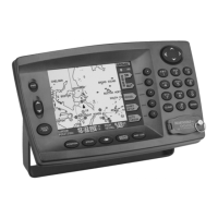
Do you have a question about the NorthStar EXPLORER 650 and is the answer not in the manual?
Covers manual and automatic power on/off procedures for the Explorer unit.
Overview of the different display modes available on the Explorer.
Introduces the two primary navigation methods: direct point-to-point and route following.
Explains how to set a destination and navigate to it, including autopilot integration.
Guides on navigating to predefined waypoints or specific points on the chart.
Details how to plan, start, and follow a route composed of multiple waypoints.
Explains how to view and interpret the electronic chart display.
Covers how to record and display the boat's course history.
Shows how to view and manage stored waypoints, including their details.
Covers creating, editing, moving, and deleting waypoints.
Step-by-step guide to creating new waypoints from chart or waypoint list.
How to modify the data associated with an existing waypoint.
Refer to section 3-1-2 for navigation instructions.
Lists and displays information about saved navigation routes.
Details creating, editing, displaying, and deleting routes.
Step-by-step guide for creating new routes from the chart or routes display.
How to modify existing routes, either on the chart or from the routes list.
Refer to section 3-1-3 for route navigation instructions.
Guides users on understanding sonar display elements and echo strengths.
Discusses the use and benefits of 50 kHz and 200 kHz sonar frequencies.
Details how fish appear on sonar, including fish symbols and arches.
Describes how gain and threshold settings control sonar detail and noise.
Shows simultaneous sonar history from 50 kHz and 200 kHz frequencies.
Step-by-step guide to creating fuel consumption curves for performance assessment.
Step-by-step guide to creating fuel consumption curves for performance assessment.
Covers system settings like language, backlight, key beep, and factory reset.
Details chart display settings including rotation, palette, and map datum.
Explains sonar settings for frequency, scroll speed, fish symbols, and filters.
Covers GPS source, DGPS, static navigation, and filtering settings.
Details fuel setup including tank size, engine count, and calibration.
Configuration for various alarms like arrival radius, anchor, and depth.
Covers system settings like language, backlight, key beep, and factory reset.
Details chart display settings including rotation, palette, and map datum.
Explains sonar settings for frequency, scroll speed, fish symbols, and filters.
Covers GPS source, DGPS, static navigation, and filtering settings.
| Display Type | Monochrome LCD |
|---|---|
| Battery Life | Up to 18 hours |
| Water Resistance | IPX7 |
| Channels | 12 |
| Waterproof | Yes (IPX7) |
| Display | Monochrome LCD |
| GPS Receiver | 12-channel |
| Waypoints | 500 |
| Routes | 20 |
| Track Log | 10, 000 points |
| Type | Handheld |