i
Table of Contents
Introduction to the MobileMapper System......................................................... 1
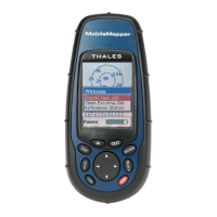
MobileMapper Field Unit............................................................................ 3
Keypad Description ............................................................................................ 3
Installing the Batteries .................................................................................. 4
Turning Power On/Off .................................................................................. 4
Setting the Screen Backlight......................................................................... 5
Setting the Units............................................................................................ 5
Getting a Position Fix ................................................................................... 5
Initialization for First-Time Use......................................................................... 6
GIS Data Logging Functions .............................................................................. 9
Feature Libraries ........................................................................................... 9
Logging New GPS/GIS Data ...................................................................... 10
Creating a Job and selecting a Feature Library ........................................................10
Logging and Describing a Point Feature..................................................................10
Logging and Describing a Line Feature...................................................................11
Logging and Describing an Area Feature ................................................................ 13
Repeating a Feature..................................................................................................14
Nesting a Feature......................................................................................................15
Offsetting a Point Feature ........................................................................................16
Offsetting a Line or Area Feature ............................................................................17
Logging GIS Data on a Preset Grid Network ..........................................................18
Changing the Parameters of a Grid Network Before Logging GIS Data................. 20
Closing a Job............................................................................................................21
GPS Accuracy............................................................................................. 22
GPS Quality Indicators ............................................................................... 22
Revisiting and Updating Existing GPS/GIS Jobs ....................................... 23
General Procedure....................................................................................................23
Repositioning a Point Feature ..................................................................................25
Adding More Features and Attributes to the Job .....................................................25
Closing the Job .........................................................................................................25
Navigation Screens ........................................................................................... 26
Map Screen ................................................................................................. 26
Compass Screen .......................................................................................... 31
Large Data Screen ....................................................................................... 32
Position Screens .......................................................................................... 33
Road Screen ................................................................................................ 35
Data Screen ................................................................................................. 36
Speedometer Screen.................................................................................... 37
Satellite Status Screen ................................................................................. 38
Customizing Data Fields on Navigation Screens........................................ 38
GOTO Function................................................................................................ 39
Purpose........................................................................................................ 39
Destination Point Types.............................................................................. 39
Selecting a GIS Feature as the Destination Point ....................................... 39
Selecting a POI as the Destination Point .................................................... 40
Saving Your Current Position as a Waypoint ............................................. 41
Creating a Waypoint With the Map Cursor ................................................ 41
Editing/Deleting a User Waypoint.............................................................. 42
Routes ............................................................................................................... 43
GOTO Route ............................................................................................... 43
Multi-leg Route ........................................................................................... 43