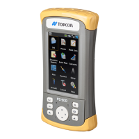
100 FC-500 Handheld Field Controller Owner’s Manual
FEATURE SPECIFICATION
Camera (Geo
models)
5MP resolution
Autofocus
LED illuminator
Video capture
JPEG image format
Geotagging; embed and/or emboss
photo with date, time and GPS/GNSS
position
Flash and ashlight
GPS/GNSS (Geo
models)
High-sensitivity GPS/GLONASS/SBAS
receiver
2 to 5 meter typical accuracy
Post processing capability for
enhanced accuracy beyond 2 to 5
meters, BINR protocol
Enhanced performance under heavy
canopy
Integrated real-time SBAS capability,
support for WAAS, MSAS, EGNOS
File format NMEA-0183 v2.3, default
strings: GGA, GSA, GLL, GSV, RMC,
VTG, ZDA, GPS
32 GNSS tracking channels
GPS/GNSS signal quality indicator on
Home screen
JSNav application
3G Data
Modem (Geo
model option)
Integrated Cinterion PH8P module
(Pentaband Worldwide), 800/850/
900/1800/1900/2100 MHz data
speeds, UMTS/HSPA+3GPP
Does not support voice calls
Communicates on GSM-based
networks