Advanced
Operations
Appendix
More Advanced
Operations
Introduction Basic Operations
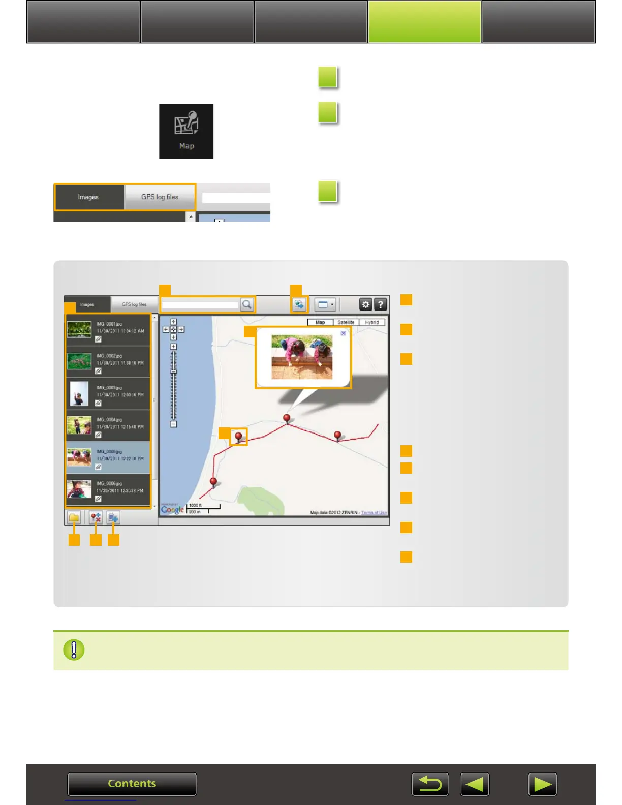
Select an image.
Click [Map].
Map Utility now starts up.
Select a display mode.
Lists the images selected in
ImageBrowser EX.
Enter a location to find corre-
sponding images.
Click to export location files
that can be viewed in Google
Earth. (Use of these files requires
Google Earth to be installed.
Note that display may be incor-
rect in some versions of Google
Earth.)
Add images.
Add or remove image location
information.
Label images in the current map
area with landmark names.
Shooting locations are indicated
by pins on the map.
The current image is shown in a
pop-up window.
1
2
3
4
5
6
7
8
1
4 5 6
7
8
2 3
Viewing or editing routes
• The buttons shown vary depending on camera/camcorder model.
Map data ©2012 ZENRIN
This Map Utility feature works with images geotagged by cameras with GPS function-
ality or cameras that can use smartphone GPS data.
1
2
3
 Loading...