68 NX605 English
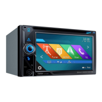
4. After a short summary of the route parameters, the map appears showing the entire route. The
route is automatically calculated. Tap
to modify route parameters, or tap
and start your journey.
Note!
Only geotagged JPG files contain location information. That is why these kind of files can only
be
used in navigation. Other picture files do not appear in the list.
Files must be located on an inserted microSD card, either in the root folder or in a "pictures"
folder.
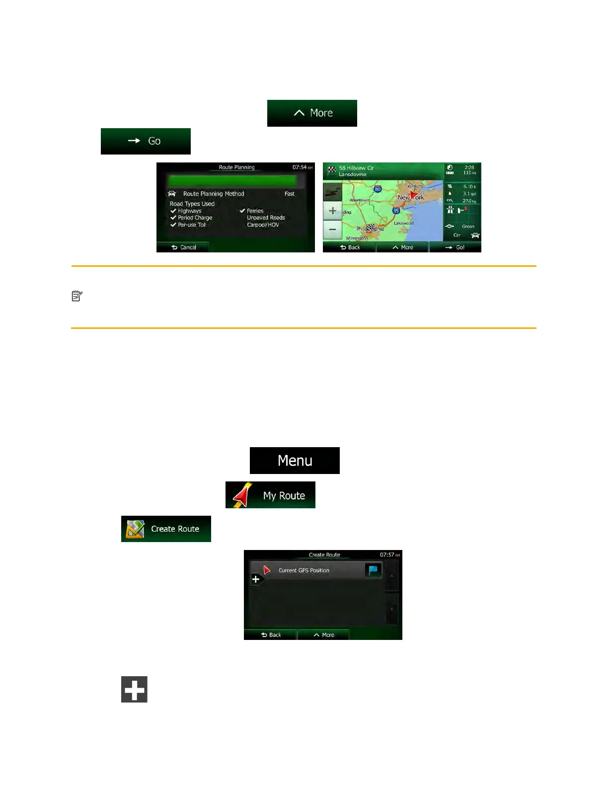
3.1.10 Building a route from the list of destinations (Create Route)
You can also build your route destination by destination from the My Route menu.
1. If you are on the Map screen, tap
to return to the Navigation menu.
2. In the Navigation menu, tap
.
3. Tap
.
4. There is only one line in the list of route points, the start point of the route, normally the current
GPS position.
5. Tap
to select the destination.

 Loading...