12 NX605 English
Gestures
(drag&drop)
You need to drag and drop the screen only in cases like:
• Moving the handle on a slider.
• Scrolling the list: grab the list anywhere and slide your finger up or down.
Depending on the speed of the sliding, the list will scroll fast or slow, only a bit
or till the end.
• Moving the map in map browsing mode: grab the map, and move it in the
desired direction.
2.3 Map screen
2.3.1 Navigating on the map
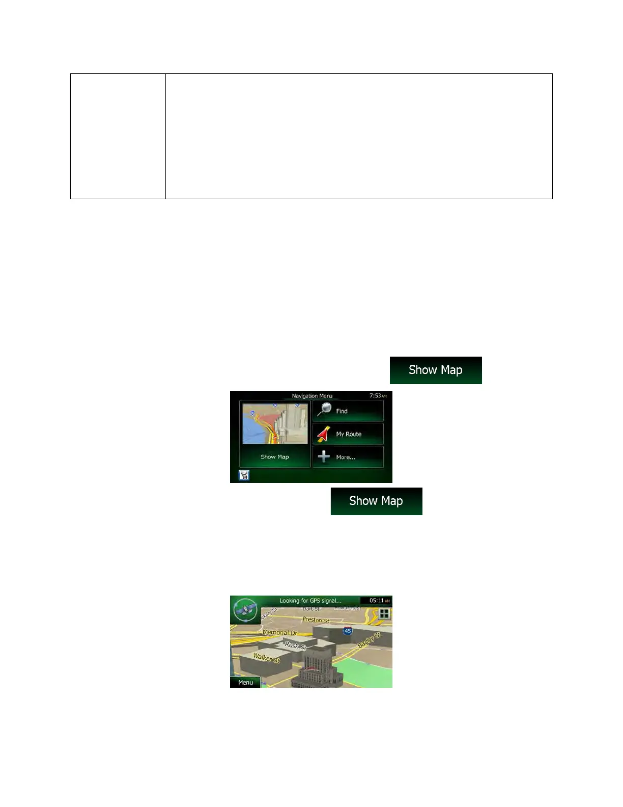
The Map screen is the most frequently used screen of Clarion Mobile Map.
A small live map is displayed on the Navigation menu, as a part of the
button.
To enlarge this small map and open the Map screen, tap
.
This map shows the current position (the Vehimarker, a blue arrow by default), the recommended route
(an orange line), and the surrounding map area.
When there is no GPS position, the Vehimarker is transparent. It shows your last known position.
You see colored dots circling around a satellite symbol in the top left corner. The more green dots you
see, the closer you are to get the valid GPS position.

 Loading...