ZENMUSE L1
User Manual
12
©
2021
DJI All Rights Reserved.
set the Side Overlap (LiDAR) to 50% or above, the Scanning Mode to Repetitive, the altitude
to 50-100 m, the ight speed to 5-10 m/s, and enable Calibration Flight.
B. Photogrammetry mission:
a. Select Zenmuse L1 and then Photogrammetry.
b. Set the advanced settings, payload settings, and other parameters. It is recommended to
disable Dewarping and set Forward Overlap (Visible) and Side Overlap (Visible) to default
parameters.
3. Select to save the ight mission and select to upload and execute the ight mission.
4. Power o the aircraft after the mission is completed and remove the microSD card from the L1.
Connect it to a computer and check the point cloud data, photos, and other les in the DCIM folder.
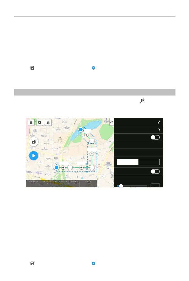
Linear Flight Mission
1. Enter the mission ight screen in DJI Pilot, select Create a Route, and then to choose a Linear
Flight mission.
2. Tap and drag on the map to adjust the area that will be scanned.
H20 T
6277 fs 12 m 49 s
32
197
55549.0 ㎡
S
460.8m
430.8m230.8m
330.8m
Equal Left/Right Extensions
Flight Band Flight Route
Left Extension Length (ft)
12
R
2.4G
80%
100%
26.1v
26.1v
3. Edit the parameters for a LiDAR Mapping mission or Photogrammetry mission.
A. LiDAR Mapping mission:
a. Select Zenmuse L1 and then LiDAR Mapping.
b. Set the advanced settings, payload, flight band, flight route, and other parameters. It is
recommended to enable Single Route. Set the altitude to 50-100 m, the ight speed to 5-10
m/s, and adjust the extension length to cover the area to be scanned.
B. Photogrammetry mission:
a. Select Zenmuse L1 and then Photogrammetry.
b. Set the advanced settings, payload settings, and other parameters. It is recommended to
disable Dewarping and set Forward Overlap (Visible) and Side Overlap (Visible) to default
parameters.
4. Select to save the ight mission and select to upload and execute the ight mission.
 Loading...