©
2021
DJI All Rights Reserved.
11
Field Data Collection
Users can create a ight mission to record point cloud data in DJI Pilot and import the recorded data
into DJI Terra for high-precision model reconstruction.
Preparation
1. Make sure the L1 is installed correctly on the aircraft and that the aircraft and remote controller are
linked after powering on.
2. Go to camera view in DJI Pilot, select , then RTK, choose the RTK service type, and make sure
that the status of RTK positioning and heading both display FIX. Refer to the Base Station Satellite
Data Acquisition section for more information on data processing if the network or remote controller
video transmission signal is poor.
3. Before recording data, it is recommended to warm up the L1 for 3 to 5 minutes after powering on.
Wait until a prompt appears in the app stating that the payload INS IMU is warmed up.
Setting Camera Parameters
1. Go to the camera view in DJI Pilot and select
CAMERA
.
2. Select to adjust the camera parameters according to the surroundings. Make sure the photo will
be well exposed.
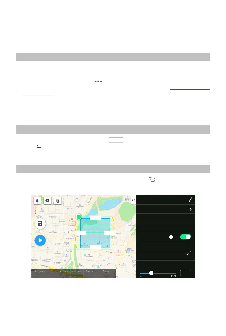
Mapping Mission
Enter the mission ight screen in DJI Pilot, select Create a Route, and then to choose a Mapping mission.
1. Tap and drag on the map to adjust the area that will be scanned.
S
224.8m
245.8m
224.8m 245.8m
H20 T
6277 fs 26 m 49 s
42
697
55549.0 ㎡
Mapping1
Altitede Mode
Relative to Takeoff Point (ALT)
Flight Route Altitude(ft)
12
R
2.4G
80%
100%
26.1v
26.1v
2. Edit the parameters for a LiDAR Mapping mission or Photogrammetry mission.
A. LiDAR Mapping mission:
a. Select Zenmuse L1 and then LiDAR Mapping.
b. Set the advanced settings, payload settings, and other parameters. It is recommended to
 Loading...