17
3.1.2.2. Area Route Planning
3.1.2.2.1. Area Route Creation
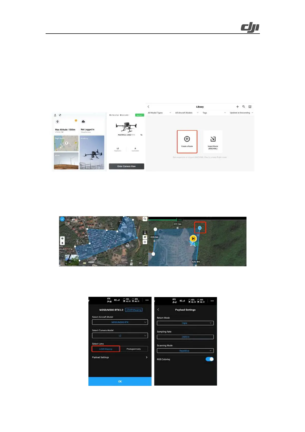
After the auto-check is complete, tap the route icon. On the Library screen, tap Create a Route or
tap Import Route (KMZ/KML) to import operation area data. Alternatively, enter the camera view,
tap the route icon, and then tap the plus icon (+) to create a route.
Figure: Route creation
Tap Area Route to enter the editing screen. Tap on the map view, and drag boundary points to a djust
the range of the mapping area. You can also tap + between two boundary points to add a boundary
point, tap the delete icon to delete a selected boundary point, and tap the clear icon to delete all
boundary points. After editing, tap the check mark to confirm the mapping area.
Figure: Mapping area editing
Select the aircraft model, select L2 for the camera model, and select LiDAR Mapping to use the
LiDAR to collect the point cloud data of the measured object. Then, tap Payload Settings.
 Loading...