19
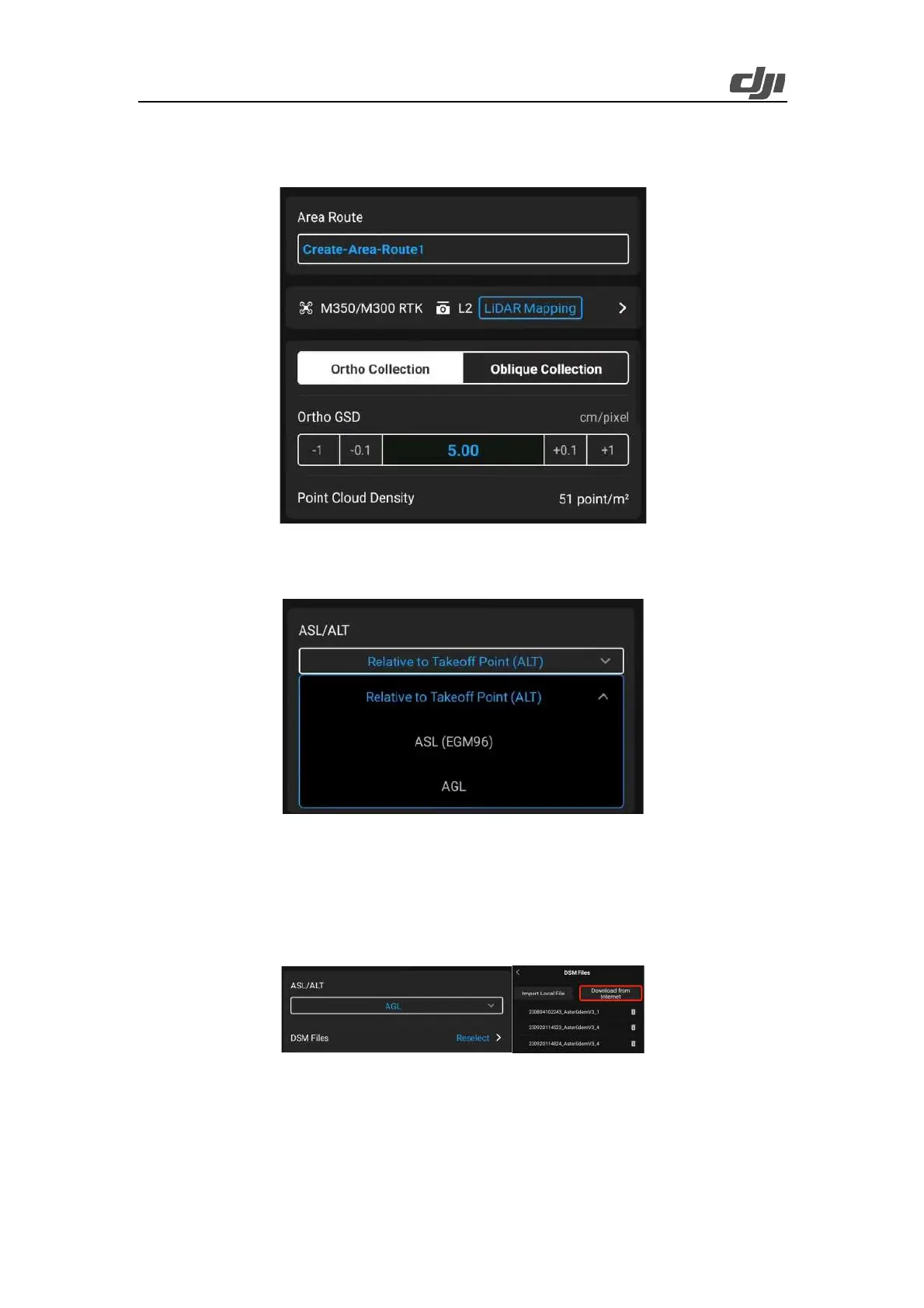
2) Set Ortho GSD, which specifies the GSD used by the RGB camera to collect images.
3) Point Cloud Density specifies the average number of LiDAR points (non-ground points) per
square meter in principle.
Figure: Route editing
4) Set ASL/ALT to Relative to Takeoff Point (ALT), ASL (EGM96), or AGL. We recommend that
you select AGL to enable Terrain Follow.
Figure: ASL/ALT setting
5) Select DSM files. Matrice 350 RTK supports two methods of obtaining terrain data: Import
Local File and Download from Internet. In this example, select Download from Internet. The
app downloads terrain elevation data of the mapping area and generates a route with altitude
changes to ensure accurate terrain follow with the aircraft flying at obtained heights with strict
accuracy.
Figure: DSM file selection
6) We recommend that you set Terrain Follow Altitude to 150 m. You can also set a lower altitude,
such as 100 m, if you need stronger laser penetrability to obtain more ground point information.
If the mapping area is sparsely vegetated, you can set a higher altitude, such as 200 m, to
improve operating efficiency.
 Loading...