Leaders in Pipeline Survey Systems
2 - 15
OPERATING MANUAL
PART 1 – OPERATION
AVW 150203 – 2010O&MPt1-Sec2.DOC
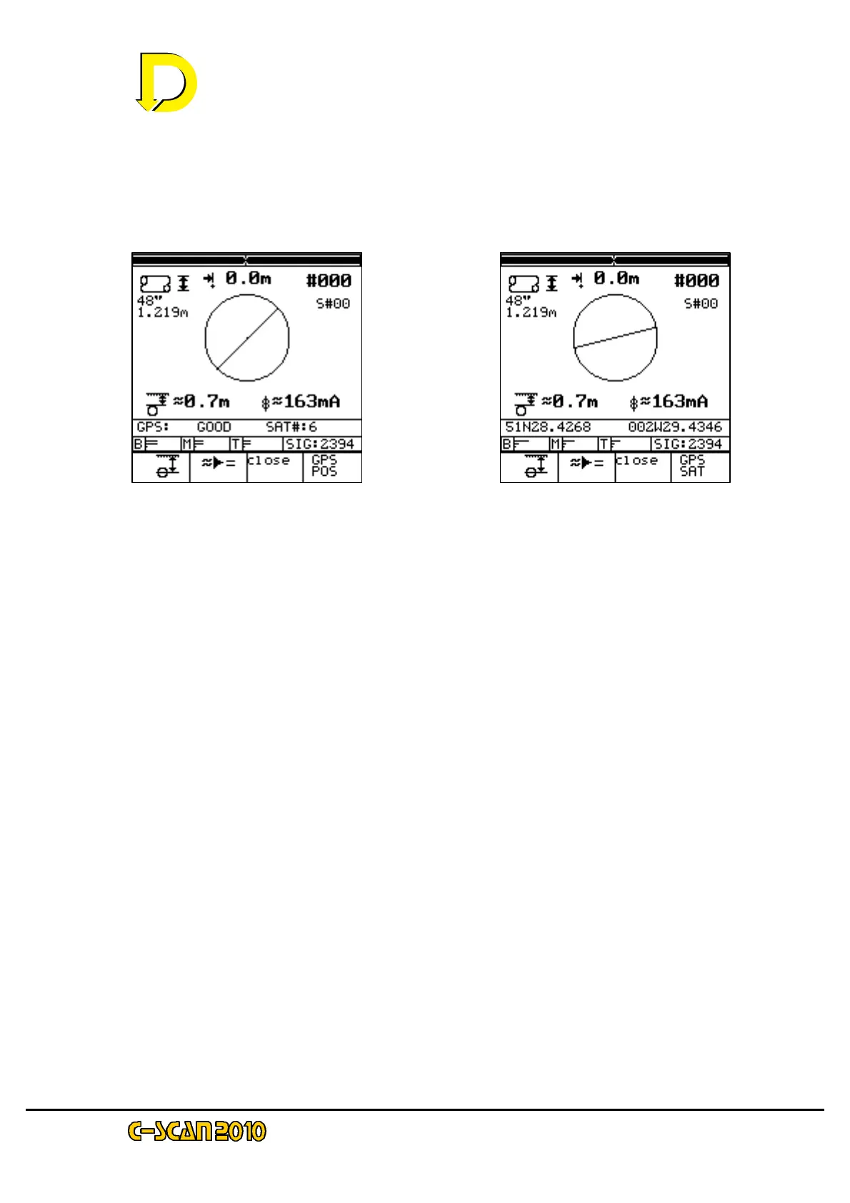
Press the key adjacent to the GPS POS box (bottom RH corner) to show the Latitude /
Longitude position of the DU – see Figs. 14 & 15 on page 2-15 below.
Move the DU towards the pipeline until the horizontal distance indicator is as close to
Zero as possible. The right and left-hand black bars at the top of the display screen
shown the precise overhead position when they are as close together as possible.
2 newly available function keys are now displayed:
- the CALCULATION key, below the ≈≈= symbol.
and
- the CLOSE key, below the ‘Close’ box
The CALCULATION key takes a large sample and converts the approximate readings
into accurate data.
NOTE: it is important that the DU is held stationary and perpendicular to the pipeline
after the CALCULATION key is pressed. Any movement will upset the readings and
result in data errors.
The CLOSE key is for CLOSE INTERVAL CURRENT SURVEY. This is discussed in
Section 4.8 later in this manual.
Keep the instrument still and press the CALCULATION key now.
NOTE: if the DU is in DEMO mode the display will be continually changing. Press the
CALCULATION key when its symbol (≈≈ =) appears.
Fig. 14 – GPS signal ‘GOOD’
with number of satellites shown
Fig. 15 – Latitude / Longitude in
this example is for Bristol UK