Leaders in Pipeline Survey Systems
4 - 6
OPERATING MANUAL
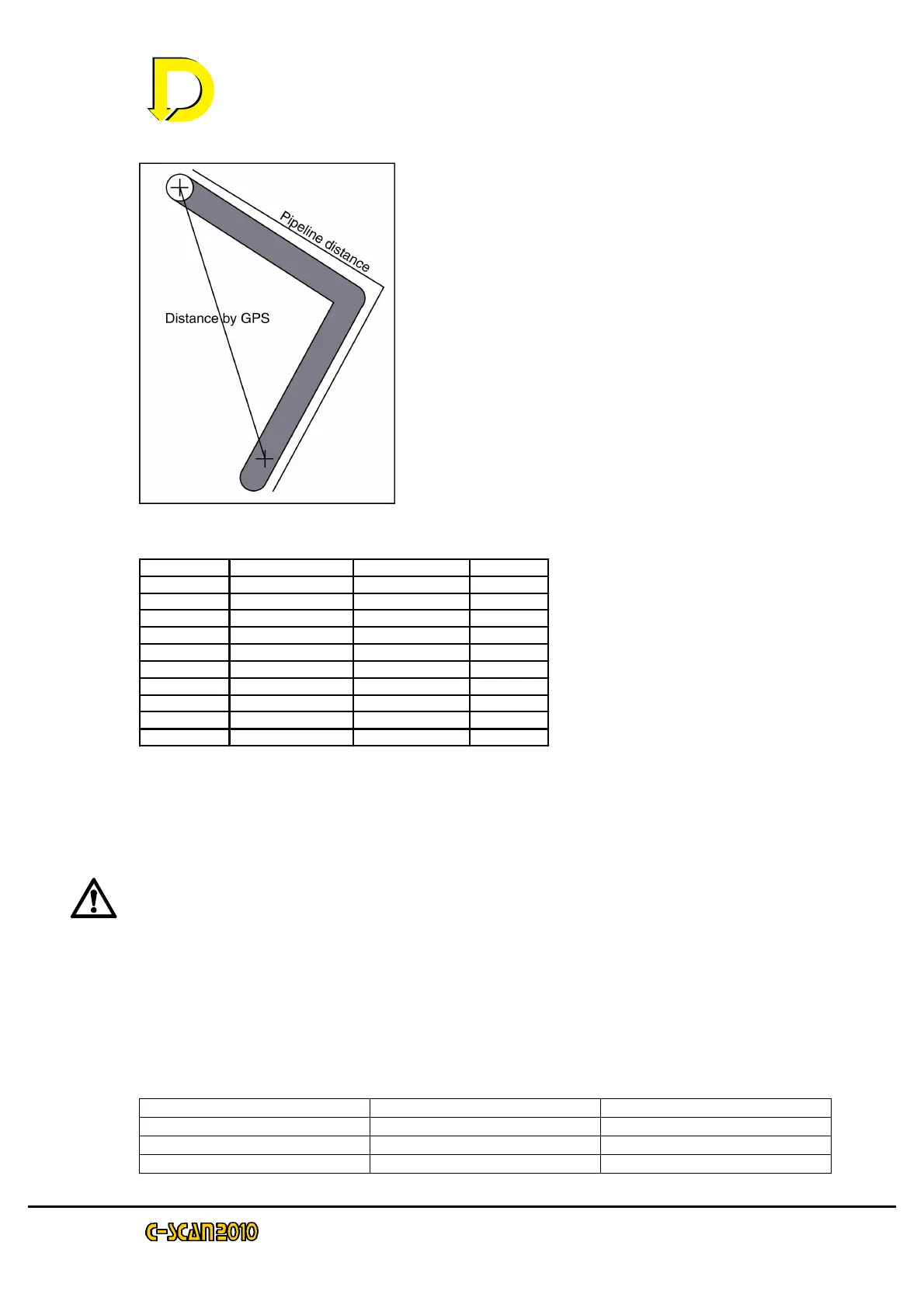
If two successive points are taken around a
bend in a pipe and GPS is being used, it is
important to enter the pipeline distance and NOT
use the GPS distance, as this will cause an
error.
Due to magnetic field distortion (the operating
design of C-SCAN relies on magnetic field) at
bends of more than 30
0
, reliable readings cannot
be taken at sharp bends - see the Survey
Procedure manual. The table below shows the
error for two readings taken 50m either side of a
bend with different angles if a direct line is
taken.
Bend angle Pipeline Distance Direct distance % error
0 100 100 0
10 100 100 0
20 100 98 2
30 101 97 3
40 102 94 7
50 103 91 11
60 104 87 16
70 105 82 21
80 106 77 27
90 107 71 33
To produce a positive (+ve) attenuation, the reading taken must be less than (<)
the last reading AND the distance must be positive (+ve). If the distance is
negative (-ve), the attenuation will be negative. A negative attenuation is hard to
visualize in relation to positive attenuations, but the main rule of thumb is:
Going away from the generator distances are positive (+ve).
Going towards the generator distance are negative (-ve)
There are three ways of entering distance. The first two we already know – GPS
and direct distance i.e. the distance between points. The third way is chainage.
4.5 Chainage
Chainage is the term given to incremental distance from the survey start point. As
an example, a survey has 4 points taken 100m apart. The chainage would be:
Point Distance Chainage
#00 0 0
#01 100 100
#02 100 200