190-00962-04 Rev. A
Garmin G1000 Pilot’s Guide for the Diamond DA42NG
227
FLIGHT MANAGEMENT
SYSTEM
OVERVIEW
FLIGHT
INSTRUMENTS
EIS
AUDIO PANEL
& CNS
FLIGHT
MANAGEMENT
HAZARD
AVOIDANCE
AFCS
ADDITIONAL
FEATURES
APPENDICES INDEX
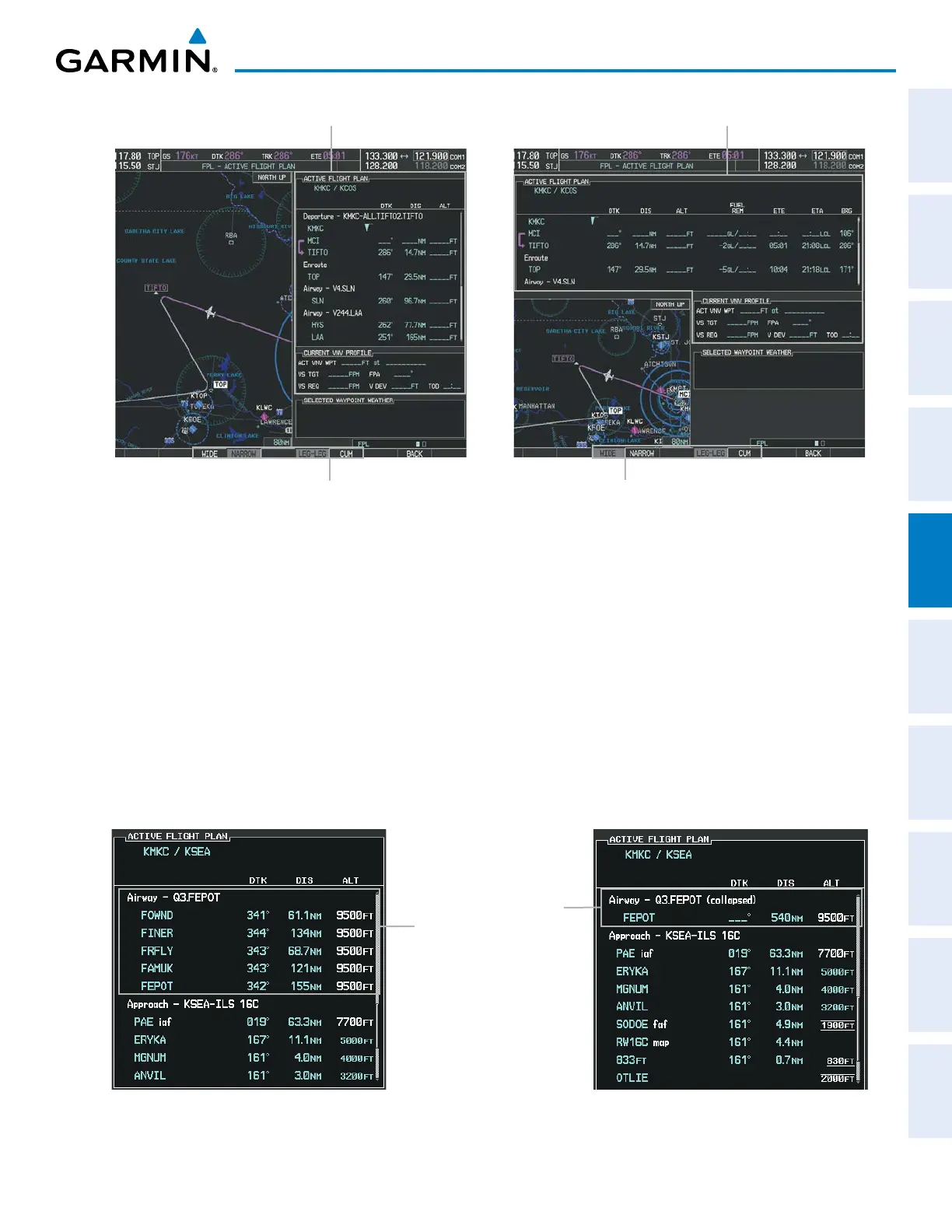
Figure 5-92 Active Flight Plan - Wide vs. Narrow View
WIDE Softkey, NARROW Softkey, LEG-LEG Softkey, CUM Softkey
Active Flight Plan
Narrow View
Active Flight Plan
Wide View
COLLAPSING AIRWAYS
The G1000 allows airways on the active flight plan to be collapsed or expanded from the Active Flight Plan
Page/Window. When airways have been collapsed, it is indicated on the airway heading.
When airways are collapsed, leg-to-leg computed values such as DIS or ETE shown for the exit waypoint
reflect the total of all the legs on the airway that have been hidden in the collapsed display. The DTK value is
inhibited because it is not usable in this context.
The Active Flight Plan Page always keeps the following three waypoints visible: “From” waypoint, “To”
waypoint, and “Next” waypoint. To prevent one or more of these waypoints from being hidden in a collapsed
airway segment, the airway segment that contains either the “To” or the “Next” waypoint is automatically
expanded. When an airway is loaded, airways are automatically expanded to facilitate flight plan review.
Figure 5-93 Expanded/Collapsed Airways
Q3.FEPOT Airway
Collapsed View
Expanded View

 Loading...


