190-00962-04 Rev. A
Garmin G1000 Pilot’s Guide for the Diamond DA42NG
239
FLIGHT MANAGEMENT
SYSTEM
OVERVIEW
FLIGHT
INSTRUMENTS
EIS
AUDIO PANEL
& CNS
FLIGHT
MANAGEMENT
HAZARD
AVOIDANCE
AFCS
ADDITIONAL
FEATURES
APPENDICES INDEX
5.8 PROCEDURES
The G1000 can access the whole range of instrument procedures available. Departures (DPs), arrivals (STARs),
and non-precision and precision approaches (APPRs) are stored within the database and can be loaded using the
Procedures (PROC) Key.
The selected procedure for the departure or arrival airport is added to the active flight plan. No waypoints are
required to be in the active flight plan to load procedures; however, if the departure and arrival airport are already
loaded, the procedure loading window defaults to the appropriate airport, saving some time selecting the correct
airport on the Procedure Loading Page. Whenever an approach is selected, the choice to either “load” or “activate”
is given. “Loading” adds the approach to the end of the flight plan without immediately using it for navigation
guidance. This allows continued navigation via the intermediate waypoints in the original flight plan, but keeps
the procedure available on the Active Flight Plan Page for quick activation when needed. “Activating” also adds
the procedure to the end of the flight plan but immediately begins to provide guidance to the first waypoint in
the approach.
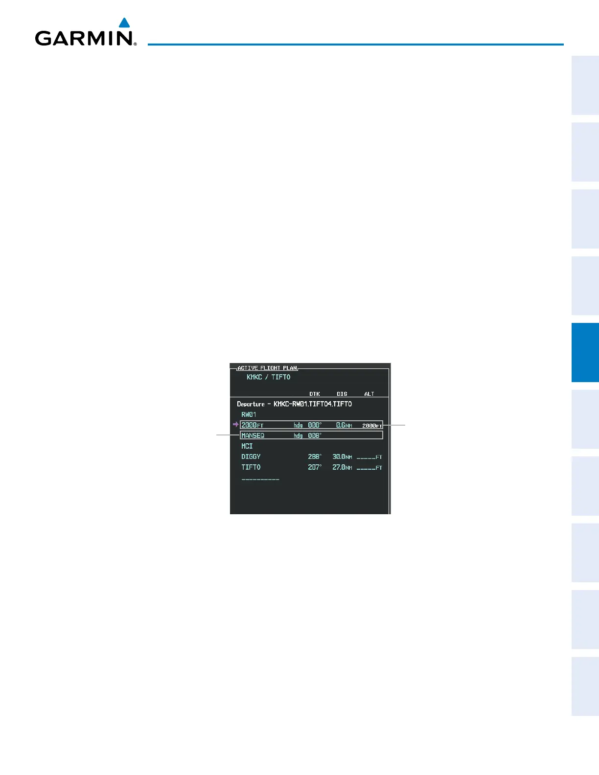
The system adds terminal procedures to the flight plan based on leg types coded within that procedure in the
navigation database. If the terminal procedure in the flight plan contains an identifier like ‘6368ft’, that indicates
a leg that terminates when the specified altitude (6368 feet) has been exceeded. A heading leg in the flight plan
displays ‘hdg’ preceding the DTK (e.g. ‘hdg 008°’). A flight plan leg requiring the pilot to manually initiate
sequencing to the next leg displays ‘MANSEQ’ as the identifier.
Figure 5-100 Procedure Leg Identifiers
Heading Leg Terminating at the
Specified Altitude
Manually Sequenced Heading Leg

 Loading...


