190-00962-04 Rev. A
Garmin G1000 Pilot’s Guide for the Diamond DA42NG
417
HAZARD AVOIDANCE
SYSTEM
OVERVIEW
FLIGHT
INSTRUMENTS
EIS
AUDIO PANEL
& CNS
FLIGHT
MANAGEMENT
HAZARD
AVOIDANCE
AFCS
ADDITIONAL
FEATURES
APPENDICES INDEX
The Map - Terrain-SVS Page is the principal page for viewing terrain and obstacle information. Terrain-SVS
information can also be displayed on the following pages and maps as an additional reference:
• PFD Inset Map
• Navigation Map Page
• Trip Planning Page
• Flight Plan Pages
• AUX - Video Page
Displaying terrain and obstacle information (maps other than the Terrain-SVS Page):
1) Press the MAP Softkey (for the PFD Inset Map, select the INSET Softkey).
2) Press the TERRAIN Softkey to display terrain and obstacle data.
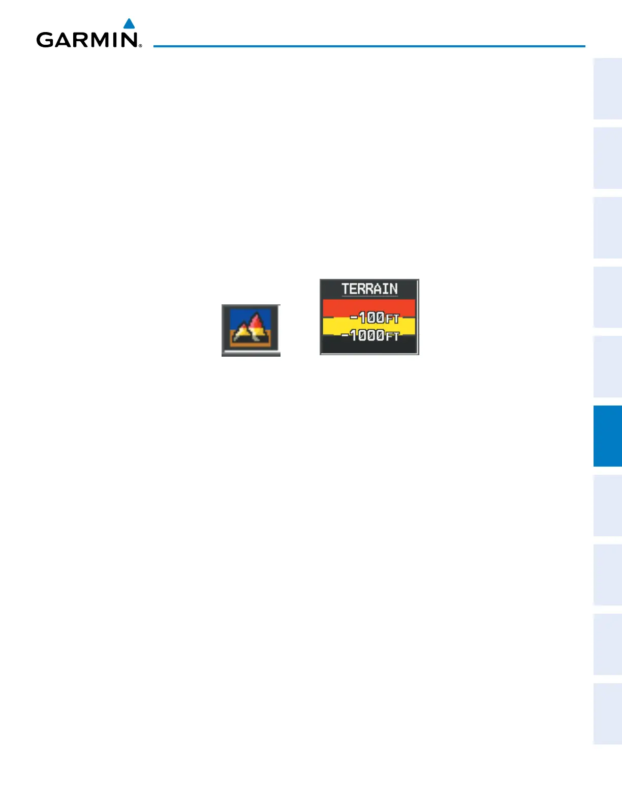
When Terrain-SVS is selected on maps other than the Terrain-SVS Page, an icon to indicate the feature is
enabled for display and a legend for Terrain-SVS terrain colors are shown (Figure 6-169).
Figure 6-169 Terrain-SVS Icon and Legend
The Navigation Map Page Setup Menu provides a means in addition to the softkey for enabling/disabling
display of terrain and obstacles. The setup menu also controls the map range settings above which terrain and
obstacle data are decluttered from the display. If a map range larger than the map range setting is selected, the
data is removed from the map. For terrain data, the enable/disable function applies only to the MFD, while the
range setting also affects the PFD Inset Map.
Terrain data can be selected for display independently of obstacle data; however, obstacles for which warnings
and cautions are issued are shown when terrain is selected for display and the map range is within the setting
limit.
Maps besides the Terrain-SVS Page use settings based on those selected for the Navigation Map Page. The
maximum display ranges for obstacles on each map are dependent on the range setting made for the Navigation
Map. If the maximum range for obstacle display on the Navigation Map is adjusted to below 20 nm, the highest
obstacle display range settings on the other applicable maps are also adjusted proportionally.
Customizing terrain and obstacle display on the Navigation Map Page:
1) Select the Navigation Map Page.
2) Press the MENU Key.
3) With ‘Map Setup’ highlighted, press the
ENT
Key (Figure 6-170).
4) Turn the small FMS Knob to select the ‘Map’ Group and press the ENT Key (Figure 6-171).
5) Turn the large
FMS
Knob or press the
ENT
Key to scroll through product selections (Figure 6-172).
• TERRAIN DATA – Turns the display of terrain data on or off and sets maximum range at which terrain is shown
• OBSTACLE DATA – Turns the display of obstacle data on or off and sets maximum range at which obstacles are shown

 Loading...


